Woodstock, Portland, Oregon facts for kids
Quick facts for kids
Woodstock
|
|
|---|---|
|
Neighborhood
|
|
 |
|
| Country | United States |
| State | Oregon |
| City | Portland |
| Area | |
| • Total | 1.30 sq mi (3.37 km2) |
| Population
(2000)
|
|
| • Total | 8,472 |
| • Density | 6,511/sq mi (2,514/km2) |
| Housing | |
| • No. of households | 3652 |
| • Occupancy rate | 96% occupied |
| • Owner-occupied | 2705 households (74%) |
| • Renting | 947 households (26%) |
| • Avg. household size | 2.32 persons |
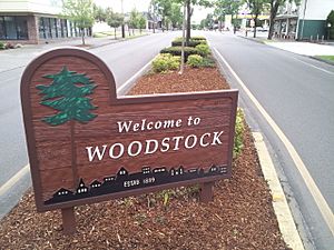
Woodstock is a neighborhood in southeast Portland, Oregon, United States. It is one of the oldest neighborhoods in the city. The area was officially mapped out, or platted, in 1889.
Woodstock is surrounded by other neighborhoods. To the west are Reed and Eastmoreland. To the north is Creston-Kenilworth. On the east, you'll find Mt. Scott-Arleta and Brentwood-Darlington. Finally, Ardenwald-Johnson Creek is to the south.
Where is Woodstock Located?
Woodstock is found in inner southeast Portland. Its northern border is Southeast Holgate Boulevard. To the east, it's bordered by Southeast 45th and Southeast 60th Streets. Johnson Creek forms its southern boundary. On the west, you'll find Cesar E. Chavez Boulevard, which used to be called Southeast 39th Avenue.
A Look Back: Woodstock's History
Woodstock is one of Portland's very first neighborhoods. It was officially mapped out in 1889. Many of the oldest homes, some built in the 1880s, are in the northern part of the neighborhood. Newer houses, built after World War II, are mostly in the northeast and southern areas.
Before the 1850s, the land where Woodstock now stands was wild. In 1848, a family led by Clinton Kelly, a Methodist minister, moved here from Kentucky. They were looking for good farmland. In 1852, Archon Kelly, Clinton's son, received 320 acres (1.3 km2) of land. This land was on a plateau overlooking what is now the Eastmoreland neighborhood and Reed College.
Archon's land was bordered by Southeast Raymond to the north, Southeast 52nd Avenue to the east, Duke Street to the south, and Southeast 42nd Avenue to the west. He lived on the farm until 1863, when he sold it to his father, Clinton.
The land changed hands a few more times. In 1889, it was divided into lots for homes. A group of five men bought 194.5 acres (0.787 km2) of the land. They named the new area Woodstock. They chose this name after a novel written in 1826 by Walter Scott called Woodstock. It was popular back then to name new neighborhoods after romantic novels.
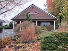
In 1893, one of these men, James Havely, built one of Woodstock's first houses. It was a Queen Anne style home on Southeast 40th Avenue. This house is now a historic landmark. James Havely also helped bring electricity and water to the neighborhood.
What's in Woodstock Today?
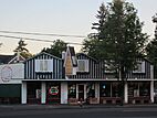
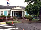
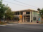
The main area for shops and community activities is called Woodstock's Village Center. It's located on Woodstock Boulevard, between Cesar E. Chavez Boulevard and 52nd Avenue. Here, you'll find churches, the Woodstock Library, and the Woodstock Community Center. There are also many businesses selling different goods and services.
Homes, including single-family houses and apartment buildings, surround the Village Center. Most of the apartment buildings are close to Woodstock Boulevard. Two schools, Woodstock Elementary and Lewis Elementary, are easy to walk to from the Village Center. Reed College is also nearby, just a couple of blocks away down the hill.
Many interesting businesses have been located along Woodstock Boulevard. Some popular spots include Otto's Sausage Kitchen, Cloud City Ice Cream, and Portland Fish Market. You can also find places like Bridge City Pizza, Dick's Primal Burger, and Nudi Noodle Place. For coffee lovers, there's an outpost of Heart Coffee Roasters.
 | George Robert Carruthers |
 | Patricia Bath |
 | Jan Ernst Matzeliger |
 | Alexander Miles |


