Woonona, New South Wales facts for kids
Quick facts for kids WoononaWollongong, New South Wales |
|||||||||||||||
|---|---|---|---|---|---|---|---|---|---|---|---|---|---|---|---|
 |
|||||||||||||||
| Population | 12,187 (2016 census) | ||||||||||||||
| Postcode(s) | 2517 | ||||||||||||||
| Elevation | 13 m (43 ft) | ||||||||||||||
| Location |
|
||||||||||||||
| LGA(s) | City of Wollongong | ||||||||||||||
| State electorate(s) | Keira | ||||||||||||||
| Federal Division(s) | Cunningham | ||||||||||||||
|
|||||||||||||||
Woonona (/wʊnoʊnə/) is a suburb in New South Wales, Australia. It is located north of Wollongong and south of Sydney. You can reach Woonona by train at Woonona Station or by car on the Princes Highway.
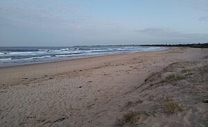
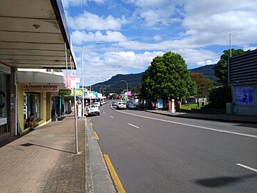
The suburb has shops along the main road and some interesting old buildings. Most homes are single-family houses, but some new two-storey buildings have appeared. Woonona Beach is a popular spot for surfing. Many surfers visit when the waves are good. There are different surf spots, including near Collins Rock and the famous "Dorrigo Ave" break.
Contents
Exploring Woonona's Geography
To the west of Woonona, you'll find the Woronora Plateau. This area is about 400 metres high. Its eastern edge is called the Illawarra Escarpment. This escarpment is covered in thick forests. East of Woonona, the land quickly slopes down to the Pacific Ocean.
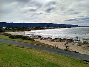
Woonona has a beach where lifeguards patrol to keep swimmers safe. There's also a rocky area called Collins Rocks. Here, you'll find a 50-metre swimming pool that uses salt water pumped from the ocean. You can still see parts of an old 100-yard tidal pool on these rocks. The Wollongong to Thirroul Bike Track runs along the park next to the beach. A small hill, where the Princes Highway goes over, makes Woonona's main shopping area slightly higher than the areas to its north and south.
A Look at Woonona's History
The name Woonona is believed to come from an Aboriginal word. It means "Place of young wallabies." Henry Fry, Woonona's first Post Master, chose this name in 1859.
The Tharawal People
Woonona has been home to the Tharawal people for at least 20,000 years. The word "Dharawal" (another spelling) refers to a local native palm tree. This Aboriginal group lived in an area stretching from Botany Bay in the north to the Shoalhaven River in the south. They also lived inland as far as Picton. Not much was written about the Dharawal people before European settlers arrived around 1830.
The Dharawal people lived in family groups. They had special scars on their skin. They used possum skins for warmth and protection. They also covered their bodies with natural materials like fat, oils, mud, and sand. This helped protect them from insects and changing weather. For special events, they wore feathers, headbands made from kangaroo teeth, and beads. Dharawal men wore bones through their pierced noses. They also had a front tooth removed to show they had become men. Dharawal women had a small part of their little finger removed. The Dharawal people carried only what they needed for hunting and eating. When European settlers arrived, the number of Dharawal people in Woonona quickly became much smaller.
Early European Settlement
Like many parts of Australia, the Woonona area was first given to settlers as land grants. Before this, people cut down cedar trees in the rich soil.
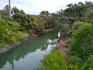
The area where Woonona is today was the first place Captain James Cook tried to land in Australia. This happened on April 28, 1770. His group desperately needed drinking water. They saw the mouth of Collins Creek as a good place to get water. However, strong waves stopped their landing party from reaching the shore. A small plaque was put up at Collins Rocks Headland in 1970 to remember this event.
In the 1800s, Woonona's main industries were dairy farming and cutting timber. So much timber was cut that photos from the early 1900s show the escarpment with almost no trees. Most of the trees left from before this time are cabbage palms. Most of the timber was sent north to Sydney for building. Cattle grazed on the coastal land, and this continued until the 1970s.
Coal mining, which started in 1857, brought many more settlers to Woonona. New families came from Wales, Cornwall, Scotland, and other parts of Great Britain to work in the mines.
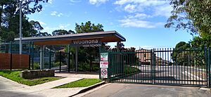
As the town grew, it had two cinemas and a large drink factory called J Parkinsons. It also had the biggest bakery on the Coast. The Woonona Cooperative building was the largest department store in the Wollongong area when it was built. Woonona Public School was built in 1882.
Bricks were also made near clay quarries in the hills above Woonona. The old Boral brickworks is now a housing area called Edgewood Estate. This area was once a home for the endangered green and gold bell frog. The estate is planned to have over 1000 houses.
In the 1970s, Woonona was mostly an area with smaller houses and lots of open space. More recently, because it is close to Sydney and has a beach, many large, modern houses have been built. In 1974, a group called the Builders Labourers Federation stopped the building of tall buildings and major roads in East Woonona. They did this after a local community group asked them to.
Much of the land near the beach was once wetlands. These areas have since been filled in. The largest filled area is Ocean Park on Carrington Road. This park was created by filling in land with rubbish until the early 1980s. A small part of the original wetland still remains west of Ocean Park.
Sports in Woonona
In the 1950s, Woonona had a soccer team. This team played in the Southern Division of the State Premiership. The team, also known as Woonona-Bulli, was one of only two teams from outside Sydney in this league.
 | Charles R. Drew |
 | Benjamin Banneker |
 | Jane C. Wright |
 | Roger Arliner Young |


