Wrangell Narrows facts for kids
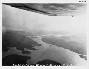
The Wrangell Narrows is a narrow, winding waterway in Southeast Alaska. It stretches about 35 kilometers (22 miles) long. This channel is located between Mitkof Island and Kupreanof Island, which are part of the Alexander Archipelago. The Wrangell Narrows is one of six special "Listed" narrows in Southeast Alaska. Because it twists and turns, and has hidden dangers, there are about 60 lights and buoys to guide boats safely through.
The Narrows got its name "Proliv Vrangelya" (which means Wrangell Strait in English) in 1838. It was named by G. Lindenberg after Admiral Ferdinand von Wrangel, a famous explorer. For a while, people used "Wrangell Strait" for the whole channel, and "Wrangell Narrows" only for the narrowest part. But by 1919, official maps changed the name of the entire channel to Wrangell Narrows.

Where is Wrangell Narrows?
The town of Petersburg is located at the northern end of the Narrows. To the east and southeast, Mitkof Island forms one side of the channel. To the north and west, the islands of Kupreanof and Woewodski Island form the other side.
The northern end of the Narrows opens up into Frederick Sound. The southern end connects to Sumner Strait.
Who Uses the Narrows?
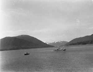
This important waterway is used by many different boats. Fishing boats travel through it to reach fishing grounds. The Alaska Marine Highway ferries, which carry cars and people, also use the Narrows.
However, very large ships, like the biggest cruise ships, cannot use the Wrangell Narrows. It is too shallow and too narrow for them to pass safely. Because this is the only safe "Inside Passage" in this area, these larger ships have to travel in the open ocean, which is called "outside waters."
There is another channel to the east of Mitkof Island called Dry Strait. Even though Dry Strait is wider, boats do not usually use it. This is because it is dangerously shallow and is part of the large Stikine River estuary.