Wright Creek (Nanticoke River tributary) facts for kids
Quick facts for kids Wright Creek |
|
|---|---|

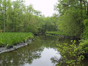
Wright Creek from Nanticoke Wildlife Area
|
|
|
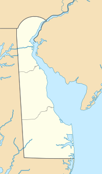
Location of Wright Creek mouth
|
|
| Other name(s) | Tributary to Nanticoke River |
| Country | United States |
| State | Maryland Delaware |
| Counties | Sussex Dorchester |
| Physical characteristics | |
| Main source | divide between Wright Creek and Turtle Branch about 3 miles west of Woodland, Delaware 34 ft (10 m) 38°33′42″N 075°42′04″W / 38.56167°N 75.70111°W |
| River mouth | Nanticoke River about 1 mile east of Galestown, Maryland 0 ft (0 m) 38°36′43″N 075°41′35″W / 38.61194°N 75.69306°W |
| Length | 4.07 mi (6.55 km) |
| Basin features | |
| Progression | south |
| River system | Nanticoke River |
| Basin size | 5.25 square miles (13.6 km2) |
| Tributaries |
|
Wright Creek is a small but important waterway that flows through parts of Delaware and Maryland in the United States. It's like a natural pathway for water, eventually joining a bigger river called the Nanticoke River. This creek is special because it forms part of the border between the two states for much of its journey.
Contents
Exploring Wright Creek
Wright Creek is a stream that stretches about 4.07 mi (6.55 km) long. It's known as a "tributary," which means it's a smaller stream that flows into a larger river. In this case, Wright Creek flows into the Nanticoke River. The area of land that drains water into Wright Creek is about 5.25 square miles (13.6 km2).
Where is Wright Creek Located?
Wright Creek is found in the eastern United States. It starts in western Sussex County, Delaware. For most of its path, the creek runs along the border between Delaware and Maryland. Specifically, it touches Sussex County in Delaware and Dorchester County in Maryland.
The Journey of Wright Creek
Wright Creek begins its journey in Delaware, about 3 miles west of a town called Woodland, Delaware. At its starting point, the land is about 34 ft (10 m) above sea level. As it flows, the creek moves generally towards the south.
Reaching the Nanticoke River
After traveling for several miles, Wright Creek reaches its end point. It flows into the Nanticoke River about 1 mile east of Galestown, Maryland. At this point, where it joins the larger river, the elevation is about 0 ft (0 m) above sea level. This means it's at the same level as the surrounding water.
Tidal Waters
An interesting fact about Wright Creek is that about half of its length is "tidal." This means that the water level in these parts of the creek goes up and down with the ocean's tides. Just like the ocean, the water in the creek rises and falls twice a day. This happens because the Nanticoke River, which Wright Creek flows into, is connected to the Chesapeake Bay and eventually the Atlantic Ocean.
 | Isaac Myers |
 | D. Hamilton Jackson |
 | A. Philip Randolph |


