Yanga, Veracruz facts for kids
Quick facts for kids
Yanga
|
|
|---|---|
|
Municipality and town
|
|
| Country | |
| State | Veracruz |
| Area | |
| • Total | 102.82 km2 (39.70 sq mi) |
| Population
(2005)
|
|
| • Total | 15,547 |
| Time zone | UTC-6 (Central Standard Time) |
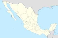
Yanga is a town and municipality in the southern part of the Mexican state of Veracruz. It is located about 80 kilometers (50 miles) from Xalapa, the state capital. This place was once known as San Lorenzo de los Negros or San Lorenzo de Cerralvo. In 1932, it was renamed Yanga to honor Gaspar Yanga. He was a brave leader of a group of people called cimarrons (which means runaway slaves) who fought for their freedom in the early 1600s.
Contents
History of Yanga
Gaspar Yanga's Journey to Freedom
Gaspar Yanga was a chief of the Punu people in what is now Gabon, a country in Central Africa. He was taken from his home and brought to Mexico as an enslaved person. It is believed he arrived in Mexico before 1570. He likely traveled through Elmina Castle, which was the first European trading post for enslaved people on the west coast of Africa.
In 1570, Yanga led a group of enslaved people to escape. They settled in the highlands, a high mountain area. In 1609, Spanish forces tried to regain control of the area, but Yanga and his group fought them off. There were more battles over almost ten years.
Negotiating for a Free Village
Finally, in 1618, Yanga talked with Spanish officials. He successfully negotiated for the freedom of the runaway enslaved people. He also gained independence for their village, which was a few kilometers from the city of Cordoba, Veracruz.
This village became known as San Lorenzo de los Negros, named after the cimarrons. It was also called San Lorenzo de Cerralvo, after a Jesuit priest named Juan Laurencio. He had been with the Spanish expedition in 1609. The agreement gave the town of San Lorenzo its "small independence."
The people of San Lorenzo declared their loyalty to the Catholic Church and the King of Spain. However, they refused to pay taxes to the Spanish government. This was a big step towards self-rule for the community.
Geography of Yanga
Location and Borders
The municipality of Yanga is located in a specific part of Veracruz. To the east, it shares a border with Cuitláhuac. To the north-east, it is next to Atoyac. To the south-east, it borders Omealca.
Climate in Yanga
The weather in Yanga is generally warm and humid. The average temperature is about 18 °C (64 °F). Most of the rain falls during the summer and autumn months.
Agriculture in Yanga
Main Crops Grown
The land in Yanga is used to grow several important crops. The main products include maize (corn), beans, sugarcane, coffee, and mango. These crops are important for the local economy.
Celebrations in Yanga
Annual Festivals and Carnivals
Yanga holds several special events throughout the year. Every February, there is a festival to honor the Virgen de Candelaria, who is the patron saint of the town. In December, another festival takes place to celebrate the Virgin of Guadalupe.
Gaspar Yanga Carnival
Every year in mid-August, a carnival is held to celebrate Gaspar Yanga. This carnival honors the former enslaved leader who bravely defended his community from the Spanish attack in 1609. Several years later, in 1618, he secured the founding of a free village and freedom for his group of maroons. This was recorded as the first free, Black self-governing region in the Americas. In August 2009, the 400th anniversary carnival was held, marking four centuries since the Spanish first attacked the settlement.
Town Twinning
Yanga has shown interest in becoming twinned with Wexford, a town in Ireland. This would create a special friendship and cultural exchange between the two places.
 | Roy Wilkins |
 | John Lewis |
 | Linda Carol Brown |


