Ysgyryd Fawr facts for kids
Quick facts for kids Ysgyryd Fawr |
|
|---|---|
| Skirrid | |
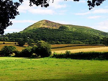
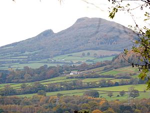
Ysgyryd Fawr from the northwest
|
|
| Highest point | |
| Elevation | 486 m (1,594 ft) |
| Prominence | 344 m (1,129 ft) |
| Parent peak | Sugar Loaf |
| Listing | Marilyn |
| Naming | |
| English translation | Great shattered [hill] |
| Language of name | Welsh |
| Geography | |
| Parent range | Black Mountains |
| OS grid | SO331182 |
| Topo map | OS Landranger 161 |
Ysgyryd Fawr (which means `Skirrid` in English) is a special mountain in Wales. It's sometimes called `The Skirrid` by people who live nearby. This mountain is part of the `Black Mountains` and the `Brecon Beacons National Park`.
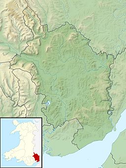
Ysgyryd Fawr is 486 meters (about 1,594 feet) tall. It stands just northeast of a town called `Abergavenny` in `Monmouthshire`. It's also only about 10 miles from the border with `England`. A famous walking path called the `Beacons Way` goes right along the top of this mountain. There's also a smaller hill nearby called `Ysgyryd Fach`, or "Little Skirrid," which is about 4.5 kilometers (2.5 miles) to the south.
How the Mountain Was Formed
Ysgyryd Fawr has a very unique shape. It's a long ridge that runs from north to south. Its western side looks jagged because of huge `landslips` that happened a long time ago, during the `ice age`.
The top parts of the mountain are made of a type of rock called `sandstone`. This sandstone is from a period called the `Devonian` age. Below this strong sandstone are softer rocks called `mudstone`. Because the softer mudstone is underneath, the steep sides of the mountain became unstable. This caused the very large landslips you can see today, especially on the western side.
You can see many other landslips on hills nearby, but the one on Ysgyryd Fawr is the most famous. In some of these slipped areas, there are many jumbled blocks of sandstone. One of these large rocks is even known as the "Devil's Table."
Legends and Stories
The Welsh name `Ysgyryd` means 'split' or 'shattered,' and `Fawr` means 'great.' This name perfectly describes the mountain's broken shape. There are many old stories and legends linked to Ysgyryd Fawr.
One famous legend says that part of the mountain broke off at the exact moment `Jesus` was crucified. People used to believe that earth from the Skirrid was holy and made things grow well. They would take soil from the mountain to spread on their fields, put in coffins, and even use in the foundations of churches. Many people would also make special trips, called `pilgrimages`, to the top of the mountain, especially on `Michaelmas` Eve.
A Look at History
In older books, you might see the mountain spelled as `Skyrrid`. It was also often called the `Holy Mountain` or `Sacred Hill` by local people. At the very top of the mountain, you can find the ruins of an `Iron Age` hill fort. There are also remains of a `medieval` chapel that was dedicated to `St. Michael`.
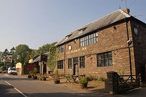
During the early 1940s, a famous prisoner named `Rudolf Hess` used to walk on this mountain. He was held at a nearby place called `Maindiff Court`. Just north of the mountain, in a village called `Llanvihangel Crucorney`, there's a pub called `The Skirrid Mountain Inn`. It claims to be one of the oldest pubs in all of Wales!
Visiting Ysgyryd Fawr
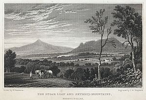
Ysgyryd Fawr has been owned by the `National Trust` since 1939. From the top of the mountain, you can see amazing views of other nearby mountains like the `Sugar Loaf` to the west and `Blorenge` to the south.
It's easy to get to the mountain from a car park next to the `B4521 road`. The path starts off steep as it goes through woods, but then it becomes easier as you reach open ground. You can enjoy a lovely walk along the top of the mountain to its highest point, where you'll find a `trig point` and the old chapel ruins. It usually takes about two hours to walk up and back down in good weather. There's also a rough path that goes around the base of the hill, which you can use for a longer circular walk.
 | Roy Wilkins |
 | John Lewis |
 | Linda Carol Brown |


