Zaraza, Guárico facts for kids
Quick facts for kids
Zaraza
|
|||
|---|---|---|---|
|
City
|
|||

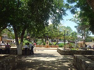
Plaza Bolivar of Zaraza
|
|||
|
|||
| Nickname(s):
La Atenas del Guarico (Athens of Guarico)
|
|||
| Country | |||
| State | Guárico | ||
| Municipality | Pedro Zaraza | ||
| Founded | April 22, 1646 | ||
| Area | |||
| • Total | 2,475 km2 (956 sq mi) | ||
| Elevation | 52 m (171 ft) | ||
| Population
(2019)
|
|||
| • Total | 58,200 | ||
| • Density | 23.515/km2 (60.90/sq mi) | ||
| Demonym(s) | Zaraceno/a | ||
| Time zone | UTC-4:30 (UTC) | ||
| postal code |
2332
|
||
| area code | 0238 | ||
| Climate | Aw | ||
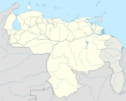
Zaraza is a lively city in Venezuela. It is the main city of the Pedro Zaraza Municipality. You can find Zaraza in the eastern part of Guárico state, which is a region known as Los Llanos. This area is famous for its wide, flat grasslands.
The city of Zaraza got its name from a brave Venezuelan soldier. He fought alongside a famous leader named Gregor MacGregor. Zaraza is one of the most important cities in Guárico State. Other big cities there include Calabozo, Valle de la Pascua, and San Juan de los Morros. In 2019, about 58,200 people lived in Zaraza.
Exploring Zaraza: Location and Landscape
Zaraza is located on the northeastern edge of the Guárico state. It sits right where two important roads, Troncal 13 and Troncal 14, meet. This makes it a key spot for travel. The city is about 52 meters (or 170 feet) above sea level. This means it's not very high up, fitting in with the flat landscape of the Llanos.
What's the Weather Like in Zaraza?
Zaraza has a Tropical Savanna Climate. This type of climate is often called "Aw" by scientists. It means the city is warm all year round. It also has a wet season and a dry season.
The driest months in Zaraza are January and February. During these months, there is very little rain, only about 4.7 millimeters on average. The wettest month is July. In July, Zaraza gets a lot more rain, with an average of 156.6 millimeters. This rain helps keep the plants and animals in the region healthy.
| Climate data for Zaraza | |||||||||||||
|---|---|---|---|---|---|---|---|---|---|---|---|---|---|
| Month | Jan | Feb | Mar | Apr | May | Jun | Jul | Aug | Sep | Oct | Nov | Dec | Year |
| Mean daily maximum °C (°F) | 35 (95) |
36 (97) |
37 (99) |
36 (97) |
35 (95) |
33 (91) |
32 (90) |
32 (90) |
33 (91) |
33 (91) |
33 (91) |
34 (93) |
34 (93) |
| Daily mean °C (°F) | 27 (81) |
28 (82) |
29 (84) |
29 (84) |
29 (84) |
27 (81) |
26 (79) |
26 (79) |
26 (79) |
27 (81) |
27 (81) |
27 (81) |
27 (81) |
| Mean daily minimum °C (°F) | 21 (70) |
21 (70) |
22 (72) |
23 (73) |
23 (73) |
22 (72) |
22 (72) |
21 (70) |
21 (70) |
22 (72) |
22 (72) |
21 (70) |
22 (71) |
| Average rainfall mm (inches) | 4.7 (0.19) |
4.7 (0.19) |
6.0 (0.24) |
29.0 (1.14) |
71.6 (2.82) |
116.8 (4.60) |
156.6 (6.17) |
155.4 (6.12) |
118.6 (4.67) |
86.0 (3.39) |
59.2 (2.33) |
24.7 (0.97) |
833.3 (32.83) |
| Average rainy days (≥ 1 mm) | 1.2 | 1.1 | 1.2 | 4.5 | 10.4 | 15.7 | 19.2 | 18.8 | 15.0 | 12.5 | 9.6 | 4.4 | 113.6 |
| Mean daily daylight hours | 11.6 | 11.8 | 12.1 | 12.3 | 12.6 | 12.7 | 12.6 | 12.4 | 12.2 | 11.9 | 11.7 | 11.6 | 12.1 |
| Source: Weatherspark.com | |||||||||||||
See also
 In Spanish: Zaraza para niños


