Calabozo facts for kids
Quick facts for kids
Calabozo
|
|||
|---|---|---|---|
|
City
|
|||
| Villa de Todos los Santos de Calabozo | |||
|
|||
| Nickname(s):
The Agro-industrial Capital
|
|||
| Country | |||
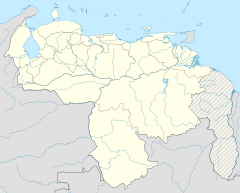
| State | Guárico | ||
| Municipality | Francisco de Miranda Municipality | ||
| Founded | 1 February 1724 by Bartolomé de San Miguel y Fray Salvador de Cádiz | ||
| Area | |||
| • Total | 52 km2 (20 sq mi) | ||
| Elevation | 105 m (344 ft) | ||
| Population
(2022)
|
|||
| • Total | 168 605 | ||
| • Density | 3.239/km2 (8.39/sq mi) | ||
| Time zone | UTC−4 (VET) | ||
| Postal Code |
2312
|
||
| Area code(s) | +58 246 | ||
| Climate | Aw | ||
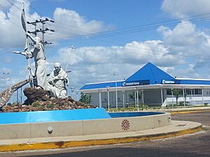
Calabozo, officially called Villa de Todos los Santos de Calabozo, is a city in Venezuela. It is found in the Guárico state. Calabozo is the capital of the Francisco de Miranda Municipality. It used to be the capital of the Guárico state.
In 2020, about 168,605 people lived there. Calabozo is in the middle-west part of Guárico state. It is known for being a major producer of rice in Venezuela. The city also has the biggest irrigation system in the country. Calabozo is often called "The Agro-industrial Capital" because of its farming.
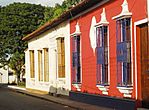
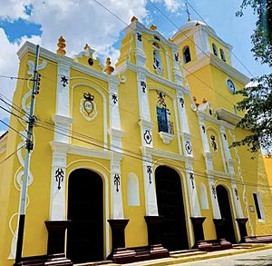
Much of Calabozo has old colonial buildings. It is the largest colonial center in Venezuela. The city is 105 meters (344 feet) above sea level. It sits by the Guárico River. Calabozo is also next to the Generoso Campilongo Dam. This dam is very important for the region. It is the largest dam in Venezuela. It is also one of the biggest in all of Latin America.
Contents
Geography
Calabozo is located on a large flat area called a llano. It is on the left side of the Guárico River. The city is about 105 meters (344 feet) above sea level. It is about 198 kilometers (123 miles) south-southwest of Caracas.
The flat land around Calabozo is a bit higher than the rivers. This means it can flood a lot when it rains. In the summer, it gets very hot. The average temperature is around 31 degrees Celsius (88 degrees Fahrenheit). There are also natural hot springs nearby.
Most people in Calabozo work with cattle. The city is well-planned with streets that cross at right angles. It has several beautiful old churches. There is also a college and a public school. Calabozo is important for trade because it is in a rich cattle-raising area.
Climate
Calabozo has a typical plains climate. The average yearly temperature is 27.5 degrees Celsius (81.5 degrees Fahrenheit). The highest monthly average is 34.4 degrees Celsius (93.9 degrees Fahrenheit). The lowest monthly average is 20 degrees Celsius (68 degrees Fahrenheit).
There are two main seasons. The dry season is from November to May. The rainy season is from May to October. The hottest months are March, April, October, and November. During these months, the heat can feel very strong.
| Climate data for Calabozo (1991–2020) | |||||||||||||
|---|---|---|---|---|---|---|---|---|---|---|---|---|---|
| Month | Jan | Feb | Mar | Apr | May | Jun | Jul | Aug | Sep | Oct | Nov | Dec | Year |
| Record high °C (°F) | 38.9 (102.0) |
39.8 (103.6) |
40.9 (105.6) |
39.9 (103.8) |
39.9 (103.8) |
36.9 (98.4) |
35.9 (96.6) |
36.1 (97.0) |
36.8 (98.2) |
36.9 (98.4) |
38.9 (102.0) |
38.7 (101.7) |
40.9 (105.6) |
| Mean daily maximum °C (°F) | 35.7 (96.3) |
36.5 (97.7) |
37.9 (100.2) |
36.3 (97.3) |
34.2 (93.6) |
32.5 (90.5) |
31.9 (89.4) |
31.9 (89.4) |
32.7 (90.9) |
35.3 (95.5) |
36.3 (97.3) |
35.0 (95.0) |
34.3 (93.7) |
| Mean daily minimum °C (°F) | 22.9 (73.2) |
23.7 (74.7) |
24.7 (76.5) |
25.7 (78.3) |
25.1 (77.2) |
24.1 (75.4) |
23.6 (74.5) |
23.5 (74.3) |
23.7 (74.7) |
23.8 (74.8) |
24.0 (75.2) |
23.4 (74.1) |
24.0 (75.2) |
| Record low °C (°F) | 10.7 (51.3) |
13.3 (55.9) |
13.0 (55.4) |
20.0 (68.0) |
21.3 (70.3) |
19.5 (67.1) |
20.0 (68.0) |
20.0 (68.0) |
20.3 (68.5) |
20.2 (68.4) |
16.2 (61.2) |
18.6 (65.5) |
10.7 (51.3) |
| Average precipitation mm (inches) | 7.8 (0.31) |
8.5 (0.33) |
8.8 (0.35) |
86.2 (3.39) |
184.8 (7.28) |
252.6 (9.94) |
260.0 (10.24) |
233.8 (9.20) |
182.2 (7.17) |
153.7 (6.05) |
76.6 (3.02) |
19.0 (0.75) |
1,474 (58.03) |
| Average precipitation days (≥ 1.0 mm) | 1.4 | 1.0 | 1.1 | 5.2 | 12.0 | 16.1 | 17.2 | 16.9 | 12.7 | 10.7 | 5.6 | 2.3 | 102.2 |
| Source: NOAA | |||||||||||||
History
Calabozo was likely an old Indian town first. It became a trading post in 1730. This was set up by the Compañía Guipuzcoana de Caracas, a trading company. Like many Venezuelan towns, Calabozo did not grow much in the 1800s.
A famous battle happened here in 1820. Spanish forces led by Francisco Tomás Morales were defeated. The revolutionists, led by Simón Bolívar and José Antonio Páez, won the battle. This was an important event in Venezuela's fight for independence.
Economy
The waters around Calabozo have many Caribbean fish. This has helped change the local economy. Calabozo has become a key place for a complex farming economy.
Agriculture
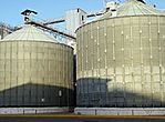
The city's large irrigation system helps a lot with farming. Farmers grow many crops like rice, corn, and beans. They also grow tobacco, tomatoes, and cotton. Cassava is another important crop.
Livestock
Raising cattle is the main type of farming here. Farmers plant special grasses for the cattle to eat. Besides meat, cattle are mostly used for milk. Calabozo is famous for making some of the best cheese in Venezuela.
Sites of Interest
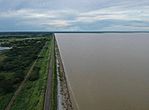
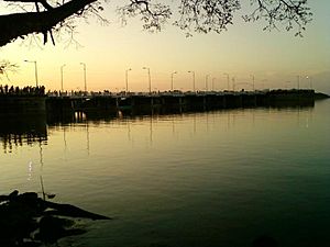
- Guarico Reservoir: This large reservoir is used to water many rice fields. It is part of the Guárico River Irrigation System. The reservoir also helps control floods during heavy rains. It was opened in 1957 by President Marcos Pérez Jiménez. It is the biggest reservoir ever built in Venezuela.
- Aguaro-Guariquito National Park: This is a protected natural area. It is a national park, meaning its wildlife and nature are kept safe.
Notable People
- Filiberto Rodríguez Motamayor (1867–1915), a writer, lawyer, and poet.
- Antonio Estévez (1916-1988), a well-known musician, composer, and conductor.
- Brusdar Graterol (1998–), a baseball pitcher for the Los Angeles Dodgers. He plays in Major League Baseball.
See also
 In Spanish: Calabozo (Venezuela) para niños
 | Kyle Baker |
 | Joseph Yoakum |
 | Laura Wheeler Waring |
 | Henry Ossawa Tanner |


