Zoutleeuw facts for kids
Quick facts for kids
Zoutleeuw
|
|||
|---|---|---|---|
 |
|||
|
|||
| Country | Belgium | ||
| Community | Flemish Community | ||
| Region | Flemish Region | ||
| Province | Flemish Brabant | ||
| Arrondissement | Leuven | ||
| Area | |||
| • Total | 46.73 km2 (18.04 sq mi) | ||
| Population
(2018-01-01)Lua error in Module:Wd at line 1575: attempt to index field 'wikibase' (a nil value).
|
|||
| • Total | Lua error in Module:Wd at line 1,575: attempt to index field 'wikibase' (a nil value). | ||
| Postal codes |
3440
|
||
| Area codes | 011 | ||
| Website | www.zoutleeuw.be | ||
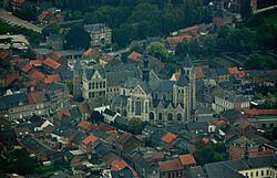
Zoutleeuw is a small but historic city in Belgium. It is located in the eastern part of the Flemish Brabant province. On January 1, 2018, about 8,498 people lived there. The city covers an area of 46.73 square kilometers. This means about 182 people live in each square kilometer.
The name Leeuw means "lion." The word Zout was added in the 1500s. Zout means "salt." This was because the town had the special right to collect a tax on salt.
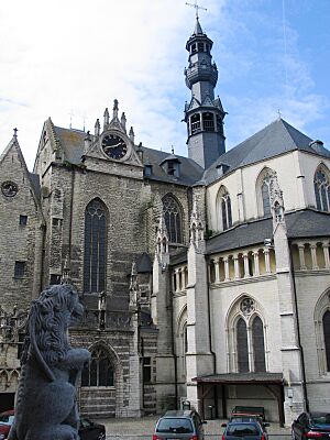
In 1999, a very important church in Zoutleeuw was recognized. The St. Leonard's Church became a World Heritage Site. This means it is a special place protected by UNESCO for its history. It is part of the "Belfries of Belgium and France" World Heritage list.
Parts of Zoutleeuw City
Zoutleeuw is made up of the main city area and several smaller towns. These smaller towns used to be separate communities. They are now part of the Zoutleeuw municipality.
- Budingen
- Dormaal
- Halle-Booienhoven
- Helen-Bos
- Ossenweg
See also
 In Spanish: Zoutleeuw para niños
 | Calvin Brent |
 | Walter T. Bailey |
 | Martha Cassell Thompson |
 | Alberta Jeannette Cassell |


