Zymagotitz River facts for kids
Quick facts for kids Zymagotitz River |
|
|---|---|
|
Mouth of Zymagotitz River
|
|
| Country | Canada |
| Province | British Columbia |
| Physical characteristics | |
| Main source | Kitimat Ranges Coast Mountains 765 m (2,510 ft) 54°36′46″N 129°5′17″W / 54.61278°N 129.08806°W |
| River mouth | Skeena River 45 m (148 ft) 54°28′57″N 128°44′4″W / 54.48250°N 128.73444°W |
| Length | 45 km (28 mi) |
| Basin features | |
| Basin size | 389 km2 (150 sq mi), |
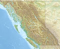
The Zymagotitz River is a river in British Columbia, Canada. It flows into the larger Skeena River. The Zymagotitz River starts high up in the Kitimat Ranges of the Coast Mountains.
This river flows for about 45 km (28 mi) towards the south and west. It joins the Skeena River about 10 km (6.2 mi) downstream from the town of Terrace. It's also about 100 km (62 mi) east of Prince Rupert.
The area of land that drains into the Zymagotitz River is called its watershed. This watershed covers about 389 km2 (150 sq mi). The average amount of water flowing in the river each year is about 24.2 m3/s (850 cu ft/s).
The Zymagotitz River watershed is part of the traditional lands of the Tsimshian Kitsumkalum people. Some of this land is currently being discussed as part of the British Columbia Treaty Process. This process helps decide land rights for Indigenous groups. The Kitsumkalum First Nation is in the fifth stage of this process.
Contents
Where Does the Zymagotitz River Flow?
The Zymagotitz River begins in the tall, icy peaks of the Kitimat Range. These peaks include mountains like Mount William Brown and Mount Morris. The river then flows south, past Kitsumkalum Mountain. It gathers water from smaller streams, such as Erlandsen Creek and Molybdenum Creek, before reaching the Skeena River.
Parks Along the River
Two provincial parks are found within the Zymagotitz River's watershed:
- Sleeping Beauty Mountain Provincial Park
- Part of Kitsumkalum Provincial Park
What Does the Land Look Like?
The land around the Zymagotitz River is mostly covered by different types of natural features:
- About 37.7% is covered by coniferous trees (like pine and fir).
- About 25.1% is barren (rocky or empty land).
- About 14.8% is covered by snow or glaciers.
- About 9.9% has herbs (small plants).
- About 8.1% has shrubs (bushy plants).
Near where the Zymagotitz River meets the Skeena River, there is an Indian reserve called Zimagord 3. This reserve belongs to the Kitsumkalum First Nation.
Animals and Nature in the Zymagotitz River
The Zymagotitz River is home to many types of salmon and trout. These fish are very important to the local ecosystem.
Fish Species
Some of the fish found in the Zymagotitz River include:
- Chinook salmon
- Chum salmon
- Coho salmon
- Pink salmon
- Steelhead trout
Changes to the Land Over Time
Since the 1950s, much of the Zymagotitz River's watershed has been used for logging. This means trees have been cut down. Starting in the 1970s, a lot of the logging involved clearcutting. This is when all the trees in an area are cut down at once.
See also
 | DeHart Hubbard |
 | Wilma Rudolph |
 | Jesse Owens |
 | Jackie Joyner-Kersee |
 | Major Taylor |


