Ñeembucú facts for kids
Quick facts for kids
Ñeembucú
Departamento de Ñeembucú
|
|||
|---|---|---|---|

|
|||
|
|||

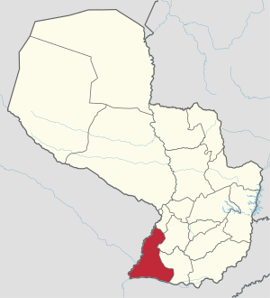
Location of Neembucu, in red, in Paraguay
|
|||
| Country | |||
| Region | Oriental | ||
| Capital | Pilar | ||
| Boroughs | 16 (See list) | ||
| Area | |||
| • Total | 12,147 km2 (4,690 sq mi) | ||
| Population
(2012)
|
|||
| • Total | 84,123 | ||
| • Density | 6.9254/km2 (17.9367/sq mi) | ||
| Demonym(s) | Paraguariense | ||
| Time zone | UTC-04 (AST) | ||
| • Summer (DST) | UTC-03 (ADT) | ||
| ISO 3166 code | PY-12 | ||
| Website | Official website: http://neembucu.gov.py/ | ||
The Ñeembucú Department (pronounced Nyeh-em-boo-KOO) is a special area, like a state or province, in the country of Paraguay. Its main city, or capital, is Pilar. You can find it on maps with the code PY-12.
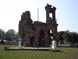
Most of Ñeembucú is countryside. It is also home to some of the oldest and best-kept ruins from the Jesuit missions. These old buildings are found near the town of Humaitá.
Contents
Exploring Ñeembucú's Geography
The Ñeembucú Department is located in the southwest part of Paraguay's Oriental region. It covers an area of about 12,147 square kilometers (4,690 sq mi). It has the fewest people living in it compared to other departments. In 2012, about 84,123 people lived here. This means there were about 6.9 people per square kilometer.
Where Ñeembucú Is Located
The department shares its borders with other areas:
- To the north: The Central department.
- To the east: The Paraguarí and Misiones departments.
- To the south: The country of Argentina, specifically the Corrientes province.
- To the west: Also Argentina, including the Chaco and Formosa provinces.
 |
Central department | Paraguarí department |  |
|
| Argentina (Formosa province) |
Misiones department | |||
| Argentina (Chaco province) |
Argentina (Corrientes province) |
Understanding Ñeembucú's Climate
In 2012, the city of Pilar received about 1,522.1 millimeters (59.9 inches) of rain. The rainiest month was February, with 284.2 millimeters (11.2 inches) of rain. The driest month was August, with only 8.0 millimeters (0.3 inches) of rain.
The average temperature in Pilar in 2012 was 22.1°C (71.8°F). January was the warmest month, with an average temperature of 27.5°C (81.5°F). July was the coolest month, with an average temperature of 15.0°C (59.0°F).
Districts of Ñeembucú
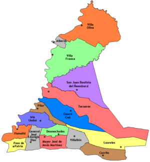
The Ñeembucú Department is divided into 16 smaller areas called districts. Each district has its own unique features.
| No. | Districts | Area (km²) |
Population (2015) |
Density |
|---|---|---|---|---|
| 1 | Alberdi | 110 | 9,034 | 82.1 |
| 2 | Cerrito | 627 | 5,522 | 8.8 |
| 3 | Desmochados | 285 | 1,780 | 6.2 |
| 4 | General José Eduvigis Díaz | 338 | 4,005 | 11.8 |
| 5 | Guazú Cuá | 882 | 2,161 | 2.5 |
| 6 | Humaitá | 321 | 3,095 | 9.6 |
| 7 | Isla Umbú | 485 | 3,007 | 6.2 |
| 8 | Laureles | 856 | 3,512 | 4.1 |
| 9 | Mayor José J. Martinez | 394 | 4,242 | 10.8 |
| 10 | Paso de Patria | 239 | 2,060 | 8.6 |
| 11 | Pilar | 258 | 32,242 | 125.0 |
| 12 | San Juan Bautista del Ñeembucú | 1,329 | 5,833 | 4.4 |
| 13 | Tacuaras | 1,872 | 3,823 | 2.0 |
| 14 | Villa Franca | 1,543 | 1,284 | 0.8 |
| 15 | Villa Oliva | 1,612 | 3,729 | 2.3 |
| 16 | Villalbín | 388 | 2,422 | 6.2 |
Related Topics
See also
 In Spanish: Departamento de Ñeembucú para niños
 | Kyle Baker |
 | Joseph Yoakum |
 | Laura Wheeler Waring |
 | Henry Ossawa Tanner |


