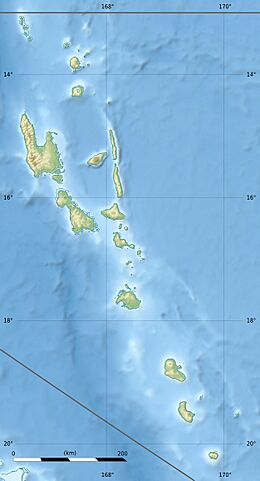
2024 Port Vila earthquake facts for kids

Strong ground motion map by USGS
|
|
| UTC time | 2024-12-17 01:47:26 |
|---|---|
| ISC event | 642646721 |
| USGS-ANSS | ComCat |
| Local date | 17 December 2024 |
| Local time | 12:47:26 VUT (UTC+11) |
| Duration | 30 seconds |
| Magnitude | 7.3 Mw |
| Depth | 57.1 km (35 mi) |
| Epicenter | 17°41′10″S 168°02′02″E / 17.686°S 168.034°E |
| Type | Oblique-slip |
| Areas affected | Efate, Vanuatu |
| Max. intensity | IX (Violent) |
| Tsunami | 25 cm (10 in) |
| Aftershocks | 300+ Strongest: Mw5.5 |
| Casualties | 16 fatalities, 210 injuries |
On December 17, 2024, a strong earthquake hit Port Vila, the capital city of Vanuatu. It happened at 12:47:26 PM local time. The earthquake had a magnitude of 7.3. Sadly, at least 16 people died, and 210 others were hurt. The earthquake caused a lot of damage in Port Vila and nearby areas. It also created a small tsunami about 25 centimeters (10 inches) high.
Contents
How Earthquakes Happen in Vanuatu
Vanuatu is located in a very active earthquake zone. This area is where two large pieces of the Earth's crust, called tectonic plates, meet. These plates are the Australian plate and the New Hebrides plate. They are constantly moving towards each other.
Plate Movement and Earthquakes
When these plates push against each other, one plate slides underneath the other. This process is called subduction. It creates a deep trench in the ocean floor, known as the New Hebrides Trench. As the plates move, they can get stuck. When they finally break free, they release a lot of energy. This energy causes the ground to shake, which we feel as an earthquake.
The plates in this area move very fast, about 170 millimeters (6.7 inches) per year. This makes it one of the most active plate boundaries in the world. Earthquakes can happen at different depths here, from shallow to very deep.
The 2024 Earthquake
The 2024 earthquake happened about 30 kilometers (19 miles) off the coast of Efate island. The United States Geological Survey (USGS) measured its strength at 7.3 magnitude. The earthquake's depth was about 57.1 kilometers (35.5 miles) below the surface.
Shaking and Aftershocks
The ground shaking lasted for about 30 seconds. After the main earthquake, there were more than 300 smaller earthquakes called aftershocks. The strongest aftershock measured 5.5 magnitude. Even though it was a strong earthquake, its depth meant it was less likely to cause a very large, damaging tsunami.
What Happened After the Earthquake
The earthquake caused a lot of damage and disruption. Many buildings were destroyed or badly damaged, especially in Port Vila.
Damage to Buildings and Roads
- At least 10 buildings collapsed in Port Vila.
- One building that housed several embassies (like the United States and United Kingdom) fell down on its ground floor.
- Roads were blocked by large landslides.
- Two bridges also collapsed, making travel difficult.
- A bus was buried by a landslide, leading to several deaths.
Impact on Services
- The Bauerfield International Airport runway and control tower were damaged. This stopped many flights.
- Two water reservoirs and the main hospital in Port Vila were damaged. Patients had to be moved to a military camp.
- Power lines were broken, causing electricity outages.
- The underwater cable that provides internet to Vanuatu was damaged. This caused internet and phone outages.
- The national broadcasting station went off air.
- Water shortages led to an increase in sicknesses like diarrhea.
Effects on People and Economy
The earthquake affected about 116,000 people, which is about one-third of Vanuatu's population. This included 14,000 children. Around 1,000 people lost their homes and had to move. About 20,000 people were left without clean water. Experts believe the earthquake could cause a lot of money loss for Vanuatu.
See also
 In Spanish: Terremoto de Port Vila de 2024 para niños
- List of earthquakes in 2024
- List of earthquakes in Vanuatu
- 2002 Port Vila earthquake
 | Mary Eliza Mahoney |
 | Susie King Taylor |
 | Ida Gray |
 | Eliza Ann Grier |


