Abiqua Creek facts for kids
Quick facts for kids Abiqua Creek |
|
|---|---|

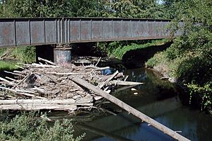
Abiqua Creek from Oregon Route 214
|
|
|
Location of the mouth of Abiqua Creek in Oregon
|
|
| Country | United States |
| State | Oregon |
| County | Marion |
| Physical characteristics | |
| Main source | Cascade Range foothills 3,331 ft (1,015 m) 44°52′32″N 122°24′29″W / 44.87556°N 122.40806°W |
| River mouth | Pudding River near Silverton 154 ft (47 m) 45°02′10″N 122°49′56″W / 45.03611°N 122.83222°W |
| Length | 29 mi (47 km) |
| Basin features | |
| Basin size | 78 sq mi (200 km2) |
Abiqua Creek (pronounced AB-ih-kwuh) is a cool stream in Oregon, USA. It flows into the Pudding River. The name "Abiqua" might come from an old Kalapuyan word. It means "hazelnut."
This creek starts in the Cascade Range mountains. It flows about 29 miles (47 km) through the state. Finally, it joins the Pudding River near Silverton. The Pudding River then flows into the Molalla River. The Molalla River soon joins the big Willamette River.
Abiqua Creek is very important for the city of Silverton. It is their main source of drinking water. The city uses a special dam to get water from the creek. People are working to help fish move freely in the creek. They are also studying the dam's fish ladder. This ladder helps fish swim past the dam.
Contents
Journey of Abiqua Creek
The creek begins in a place called the Abiqua Basin. This is about 5 miles (8 km) north of Silver Falls State Park. The creek flows down a deep canyon. Hills on either side separate its water from other nearby creeks.
As it flows, Abiqua Creek gets water from smaller streams. These are called tributaries. Some of these include Sweet Spring Creek and Wildcat Creek. Further along, Trinity Falls Creek, Bucket Creek, and Homestead Creek also join. Johnson Creek and Goober Creek add their water too.
Amazing Abiqua Falls
After Goober Creek, the stream reaches a spectacular spot. This is where Abiqua Creek plunges 101 feet (31 meters) down! This amazing waterfall is called Abiqua Falls. It's a beautiful sight to see.
Below the falls, the creek flows near Milk Ranch Road. It then follows Abiqua Road. More streams join the creek here. These include Hammond Creek, Echo Creek, and Powers Creek.
Historic Gallon House Bridge
Closer to its end, Abiqua Creek flows under two main roads. First, it goes under Oregon Route 213. Then, it passes under Oregon Route 214.
Soon after, the creek flows under Gallon House Road. This road is carried by the famous Gallon House Bridge. This bridge is a historic covered bridge. It's a cool piece of history! Finally, the creek goes under Mount Angel Highway. Then, it reaches the Pudding River.
Water Flow and Fish
A special monitor measures how much water flows in Abiqua Creek. This monitor is near Gallon House Road. The amount of water can change a lot. It can be very low or flow very fast. The monitor helps people understand the creek's health.
Drinking Water and Fish Passage
Abiqua Creek is a key water source for Silverton. The city also gets water from Silver Creek. A dam on Abiqua Creek helps get water to the city. This dam is located about 10 miles (16.7 km) upstream. Because it's high up, water flows to the city without needing pumps.
Since 2007, different groups have been working together. These include Silverton, the Pudding River Watershed Council, and the Oregon Department of Fish and Wildlife (ODFW). They want to make it easier for fish to move along the creek. They are checking how well the dam's fish ladder works. This ladder was built way back in 1916!
Abiqua Creek is home to native fish. These include winter steelhead and potentially spring chinook salmon. The creek has always been a very important place for steelhead to lay their eggs. You can fish for coastal cutthroat trout in the creek. However, fishing for salmon and steelhead is not allowed.
 | Georgia Louise Harris Brown |
 | Julian Abele |
 | Norma Merrick Sklarek |
 | William Sidney Pittman |


