Acushnet River facts for kids
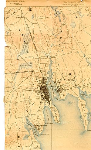
The Acushnet River is a river in southeastern Massachusetts, United States. It is about 8.6 miles (13.8 kilometers) long. This river flows into Buzzards Bay, which is part of the Atlantic Ocean.
The name "Acushnet" comes from the Wampanoag or Algonquian word "Cushnea". This word means "as far as the waters". The native people used it to describe the land they sold to English settlers. The English settlers from Plymouth Colony thought "Cushnea" was the name of the river itself.
Contents
Where the Acushnet River Flows
The Acushnet River starts at Long Pond in Lakeville, Massachusetts. A small stream called Squam Brook flows out of Long Pond. It passes through Freetown. This stream then fills the New Bedford Reservoir in the town of Acushnet.
From the reservoir, the river flows south. It forms the border between Acushnet and the city of New Bedford. Further south, it separates New Bedford on its west side from Fairhaven on its east side. Finally, the river flows into Buzzards Bay.
Bridges Over the Acushnet River
Six bridges cross the Acushnet River. Three short bridges are in Acushnet, where the river is narrow. As the river leaves Acushnet, it gets wider. It forms New Bedford Harbor, which is like a sheltered bay.
A larger bridge, the Coggeshall Street Bridge, crosses between Fairhaven and New Bedford. About 150 meters south of that, Interstate 195 crosses the river on another large bridge.
The last crossing is a set of three smaller bridges. These bridges carry US Route 6 across the wide New Bedford Harbor. They connect different small islands. First, a short bridge goes from New Bedford to Fish Island. Then, the New Bedford-Fairhaven Bridge crosses the main river channel. This is a swing bridge that opened in 1902. It can swing open to let boats pass. Finally, the Pope's Island Bridge connects Pope's Island to Fairhaven.
New Bedford Harbor Hurricane Barrier
A huge structure called the New Bedford Harbor Hurricane Barrier protects the area. It was built starting in 1958. This barrier helps stop big waves and floods during storms. It runs from Fort Phoenix in Fairhaven to Gifford Street in New Bedford.
The barrier is 20 feet (6 meters) high. It continues onto land, with three large doors for street traffic. These doors can close during storms. The barrier is made of rocks and earth. It is about 3 kilometers (1.8 miles) long.
In the middle of the barrier, there is a control tower. It has large doors that can close to block storm surges from the ocean. This barrier is the largest stone structure on the East Coast of the United States.
Historical Importance of the River
The Acushnet River was very important to the first European settlers. It gave them water, food, and a way to travel. The river helped early communities grow from small homes to villages and then to towns and cities.
Many mills were built along the river's banks, especially in New Bedford. The river's mouth forms a safe harbor. This harbor has been home to New Bedford's commercial fishing boats for a long time. It is also where New Bedford's whaling industry began. The Dartmouth, the first ship built in New Bedford, sailed from this river. This ship later became famous for its role in the Boston Tea Party.
On the Fairhaven side of the river, Fort Phoenix guards the mouth of the river. In 1775, this fort was involved in the first naval fight of the American Revolutionary War.
 | Janet Taylor Pickett |
 | Synthia Saint James |
 | Howardena Pindell |
 | Faith Ringgold |


