Adelaide Island facts for kids

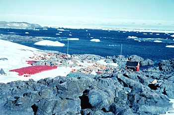
Adelaide Base, February 1962
|
|

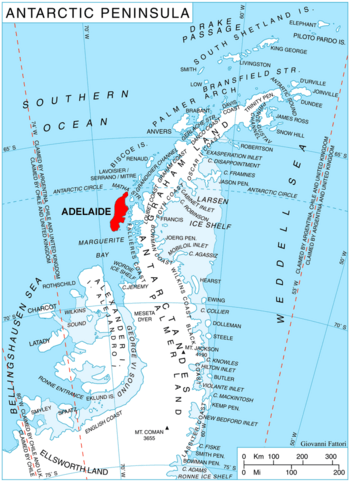
Adelaide Island shown within the Antarctic Peninsula
|
|
| Geography | |
|---|---|
| Location | Antarctica |
| Coordinates | 67°15′S 68°30′W / 67.25°S 68.5°W |
| Area | 4,663 km2 (1,800 sq mi) |
| Length | 139 km (86.4 mi) |
| Width | 37 km (23 mi) |
| Highest elevation | 2,315 m (7,595 ft) |
| Highest point | Mount Gaudry |
| Administration | |
| Administered under the Antarctic Treaty System | |
| Demographics | |
| Population | around 100 |
Adelaide Island is a large island in Antarctica. It is mostly covered in ice. The island is about 139 kilometers (75 nautical miles) long and 37 kilometers (20 nautical miles) wide. It sits on the north side of Marguerite Bay, off the west coast of the Antarctic Peninsula.
The Ginger Islands are located near its southern end. Mount Bodys is the easternmost mountain on Adelaide Island. It rises to over 1,220 meters (4,000 feet). The island is part of areas claimed by Argentina, the United Kingdom, and Chile.
Contents
History of Adelaide Island
Adelaide Island was found in 1832 by a British team. This team was led by John Biscoe, an explorer. Later, a French Antarctic Expedition surveyed the island. This survey happened between 1908 and 1910. Jean-Baptiste Charcot led the French expedition.
Biscoe himself named the island. He chose the name to honor Adelaide of Saxe-Meiningen. She was the Queen of the United Kingdom at that time.
The island has been home to two research stations. The first was the old Adelaide Island base, also called Base T. The Falkland Islands Dependencies Survey (FIDS) set it up. This group later became the British Antarctic Survey (BAS).
The old base had to close because its runway for planes became unsafe. So, operations moved to a new station called Rothera Research Station. This happened between 1976 and 1977. Rothera Station is still open today.
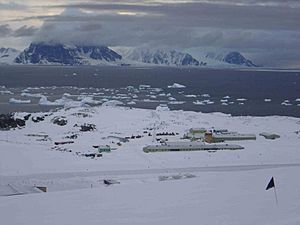
In 1984, the old BAS base was given to Chile. Chile renamed it Teniente Luis Carvajal Villaroel Antarctic Base. The Chileans used it only during the summer months. However, its runway and the path from the plateau became too unstable. Because of this, the Chilean Air Force stopped using it. The Chilean Navy visits the station almost every summer to check on it. BAS employees also visit in winter when it is easier to reach.
Because people have lived on the island for a long time, it is very well mapped. This is unusual for Antarctic areas.
Geography of Adelaide Island
Many places on and around Adelaide Island have been mapped. The French Antarctic Expedition of 1909, led by Charcot, did much of this work.
Northern Features
Cape Mascart is the northernmost tip of Adelaide Island. Charcot's expedition found it. He named it after Éleuthère Mascart, a French scientist.
Eastern Coast Features
On the east coast, Landauer Point marks the west side of the north entrance to Tickle Channel. The Falkland Islands Dependencies Survey mapped it. They used air photos from the Ronne Antarctic Research Expedition (1947–48). They also used photos from the Falkland Islands and Dependencies Aerial Survey Expedition (1956–57). The point was named for Joseph K. Landauer, an American physicist.
Further south is Mothes Point. It is about 7 kilometers (7 nautical miles) southwest of The Gullet. FIDS mapped it using photos from RARE and FIDASE. It was named for Hans Mothes, a German scientist who studies glaciers.
Continuing south, you find Mackay Point. It is about 2 kilometers (2 nautical miles) north-northeast of Rothera Point. FIDS surveyed it in 1961–62. A Royal Navy team also surveyed it in 1976–77. The point was named in 1978 for Donald C. Mackay, a builder for the British Antarctic Survey.
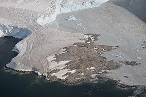
About 2 kilometers (2 nautical miles) south is Rothera Point. This point marks the east side of Ryder Bay. The point was named for John M. Rothera, a surveyor for FIDS. Rothera Point is a special protected area, called Antarctic Specially Protected Area (ASPA) No.129. This protects it as a place for biological research. It also helps scientists check how the nearby Rothera Research Station affects the environment.
Southern Coast Features
On the southeast coast of the island, Ryder Bay cuts into the land. It is about 6 kilometers (6 nautical miles) wide and 4 kilometers (4 nautical miles) deep. This bay is about 5 kilometers (5 nautical miles) east of Mount Gaudry. The Léonie Islands are located at the entrance of this bay.
The British Graham Land Expedition (BGLE) surveyed the bay again in 1936. FIDS also surveyed it in 1948. The bay is named for Lisle C.D. Ryder. He was the second mate on the ship Penola during the BGLE from 1934 to 1937. Ives Bank is an underwater bank in the Bellingshausen Sea. It is located near the southern entrance to Ryder Bay.
The very southeast tip of the island is Cape Alexandra. Charcot named it after Alexandra of Denmark. She was the Queen of England at that time.
Cape Adriasola is a distinct cape with ice cliffs. It is at the southwest end of Adelaide Island. It is about 10 nautical miles (19 kilometers) northwest of Avian Island. Charcot named it after someone he knew in Punta Arenas.
See also
 In Spanish: Isla Adelaida para niños
 | Claudette Colvin |
 | Myrlie Evers-Williams |
 | Alberta Odell Jones |


