Alango Township, St facts for kids
Quick facts for kids
Alango Township, Minnesota
|
|
|---|---|
|
Township
|
|

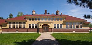
The 1927 Alango School
|
|
| Country | United States |
| State | Minnesota |
| County | Saint Louis |
| Area | |
| • Total | 36.1 sq mi (93.6 km2) |
| • Land | 36.1 sq mi (93.6 km2) |
| • Water | 0.0 sq mi (0.0 km2) |
| Elevation | 1,401 ft (427 m) |
| Population
(2010)
|
|
| • Total | 258 |
| • Density | 7.147/sq mi (2.756/km2) |
| Time zone | UTC-6 (Central (CST)) |
| • Summer (DST) | UTC-5 (CDT) |
| FIPS code | 27-00568 |
| GNIS feature ID | 0663394 |
Alango Township is a small community located in Saint Louis County, Minnesota, in the United States. A township is a type of local government area. In 2010, about 258 people lived here.
You can reach Alango Township using Saint Louis County Roads 22 and 25. Other roads like Heino Road and Samuelson Road also run through the area. The city of Cook is a nearby community.
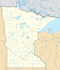
Where is Alango Township?
Alango Township covers an area of about 36.2 square miles (93.6 square kilometers). All of this land is dry land; there are no large lakes or rivers within the township itself.
Land and Water
Several small streams flow through Alango Township. These include Alango Creek in the northwest, Paavola Creek in the south-central part, and Gilmore Creek in the west-central and central areas.
A large part of the southern area of Alango Township is inside the Superior National Forest. This is a huge forest managed by the government. Also, the northwest, west-central, and southern parts of the township are within the Sturgeon River State Forest. These forests offer beautiful natural spaces.
Neighbors of Alango
Alango Township is surrounded by many other townships and communities. Here are some of its neighbors:
- Field Township (to the north)
- Owens Township and the city of Cook (to the northeast)
- Angora Township and the communities of Angora and Sherman Corner (to the east)
- Sand Lake Unorganized Territory and Britt (to the southeast)
- Leander Lake Unorganized Territory (to the south)
- Dark River Unorganized Territory (to the southwest)
- Sturgeon Township and Sturgeon (to the west)
- Linden Grove Township and Linden Grove (to the northwest)
Some roads mark the boundaries of the township. Leander Road runs along the northern edge, Ralph Road along the eastern edge, Goodell Road along the southern edge, and Carpenter Road along the western edge.
Who Lives in Alango?
In 2000, there were 301 people living in Alango Township. This meant there were about 8.3 people per square mile. Most of the people living in the township were White. Some residents also identified as Native American or from two or more races.
Many families in Alango Township have roots from different countries. According to the 2000 census, many people had Finnish, Swedish, German, Norwegian, Irish, and Polish backgrounds.
The community has a mix of age groups. In 2000, about a quarter of the population was under 18 years old. About 10% were 65 years or older. The average age in the township was 39 years old.


