Aldora, Georgia facts for kids
Quick facts for kids
Aldora, Georgia
|
|
|---|---|

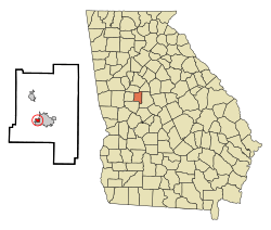
Location in Lamar County and the state of Georgia
|
|
| Country | United States |
| State | Georgia |
| County | Lamar |
| Government | |
| • Type | City commission government |
| Area | |
| • Total | 0.26 sq mi (0.66 km2) |
| • Land | 0.24 sq mi (0.62 km2) |
| • Water | 0.02 sq mi (0.04 km2) |
| Elevation | 817 ft (249 m) |
| Population
(2020)
|
|
| • Total | 0 |
| • Density | 0.00/sq mi (0.00/km2) |
| Time zone | UTC-5 (Eastern (EST)) |
| • Summer (DST) | UTC-4 (EDT) |
| FIPS code | 13-01248 |
| GNIS feature ID | 0331014 |
Aldora is a small town located in Lamar County, Georgia, in the United States. In the 2020 census, the town's official population was recorded as 0. This happened because no one living there responded to the census survey. However, the actual number of people living in Aldora was estimated to be around 103.
Contents
History of Aldora
Aldora officially became a town in 1906. This happened when the Georgia General Assembly, which is like Georgia's state parliament, approved its creation.
Geography of Aldora
Aldora is found in the south-central part of Lamar County. Its exact location is 33°2′57″N 84°10′32″W / 33.04917°N 84.17556°W.
Nearby Towns and Roads
To the east of Aldora is Barnesville, which is the main town and county seat of Lamar County.
Several important roads pass through or near Aldora:
- Georgia State Route 18 goes through the southern part of town. It leads east to Barnesville and west about 14 miles (23 km) to Zebulon.
- U.S. Route 41 and State Route 7 form the eastern edge of Aldora. These roads go north about 16 miles (26 km) to Griffin and east the same distance to Forsyth.
Size and Water
Aldora covers a total area of about 0.26 square miles (0.66 square kilometers). Most of this area is land, about 0.24 square miles (0.62 square kilometers). A small part, about 0.02 square miles (0.04 square kilometers), is water. This means about 6.50% of the town's area is water.
The water in Aldora flows west into Little Potato Creek. This creek is part of Potato Creek, which then flows into the Flint River.
Population of Aldora
The number of people living in Aldora has changed over many years. Here's a look at the population counts from different census years:
| Historical population | |||
|---|---|---|---|
| Census | Pop. | %± | |
| 1920 | 365 | — | |
| 1930 | 595 | 63.0% | |
| 1940 | 746 | 25.4% | |
| 1950 | 591 | −20.8% | |
| 1960 | 535 | −9.5% | |
| 1970 | 322 | −39.8% | |
| 1980 | 139 | −56.8% | |
| 1990 | 127 | −8.6% | |
| 2000 | 98 | −22.8% | |
| 2010 | 103 | 5.1% | |
| 2020 | 0 | −100.0% | |
| U.S. Decennial Census 1850-1870 1880 1890-1910 1920-1930 1930-1940 1940-1950 1960-19801980-2000 |
|||
Population Details from 2000
According to the census taken in 2000, there were 98 people living in Aldora. These people lived in 43 different homes, and 30 of these were families. The town had about 298 people per square mile (115 people per square kilometer).
In 2000, about 19.4% of the population was under 18 years old. About 25.5% of the people were 65 years old or older. The average age of people in Aldora was 50 years.
Education in Aldora
All the schools in Aldora are part of the Lamar County School District. This means that students living in Aldora attend schools managed by this district.
See also
 In Spanish: Aldora para niños
 | John T. Biggers |
 | Thomas Blackshear |
 | Mark Bradford |
 | Beverly Buchanan |

