Aldrich Mountains facts for kids
Quick facts for kids Aldrich Mountains |
|
|---|---|

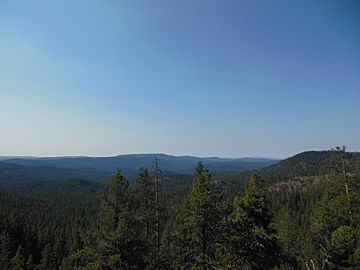
The Aldrich Mountains just south of Fields Peak
|
|
| Highest point | |
| Peak | Fields Peak |
| Elevation | 7,362 ft (2,244 m) |
| Geography | |
| Country | United States |
| State | Oregon |
| County | Grant |
| Range coordinates | 44°18′55″N 119°18′29″W / 44.31528°N 119.30806°W |
| Topo map | USGS Big Weasel Springs |
The Aldrich Mountains are a mountain range in Grant County, Oregon, United States. They are a cool place to explore nature. These mountains stretch from east to west. They rise up just south of the John Day River valley.
Contents
Exploring the Aldrich Mountains
The Aldrich Mountains are a special part of Oregon. They offer beautiful scenery and a chance to see wildlife. Most of these mountains are inside a large protected area.
Where are the Aldrich Mountains Located?
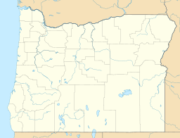
The Aldrich Mountains are found in Grant County, Oregon. They have natural borders all around them. To the west, you'll find the South Fork John Day River. To the south are Murderers Creek and Bear Valley. Canyon Creek is on their eastern side.
Most of the Aldrich Mountains are part of the Malheur National Forest. This forest is a big area where nature is protected. The closest town to the mountains is Mount Vernon. It is located in the John Day River valley.
What is the Highest Point?
The tallest spot in the Aldrich Mountains is called Fields Peak. It stands at 7,362 feet (2,244 meters) high. Imagine the views from up there!
Neighboring Mountain Ranges
The Aldrich Mountains have other mountain ranges nearby. Across the South Fork John Day River to the west are the Ochoco Mountains. If you go across Canyon Creek to the east, you will find the Strawberry Range.
 | William Lucy |
 | Charles Hayes |
 | Cleveland Robinson |


