Mount Vernon, Oregon facts for kids
Quick facts for kids
Mt. Vernon, Oregon
|
|
|---|---|
|
City
|
|

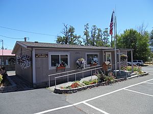
Mount Vernon City Hall
|
|

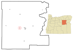
Location in Oregon
|
|
| Country | United States |
| State | Oregon |
| County | Grant |
| Incorporated | 1948 |
| Area | |
| • Total | 0.68 sq mi (1.77 km2) |
| • Land | 0.68 sq mi (1.77 km2) |
| • Water | 0.00 sq mi (0.00 km2) |
| Elevation | 2,861 ft (872 m) |
| Population
(2020)
|
|
| • Total | 548 |
| • Density | 802.34/sq mi (309.97/km2) |
| Time zone | UTC-8 (Pacific) |
| • Summer (DST) | UTC-7 (Pacific) |
| ZIP code |
97865
|
| Area code(s) | 541 |
| FIPS code | 41-50250 |
| GNIS feature ID | 2411182 |
Mount Vernon is a small city located in Grant County, Oregon, in the United States. It was officially made a city in 1948.
The city got its name from a black stallion (a male horse) owned by an early settler named David W. Jenkins. The post office in Mount Vernon was first opened in 1877. You can still see the stone building that was once the stallion's stable. It is about 2.2 miles (3.5 km) east of the town's main intersection, on the north side of U.S. Highway 26.
In 1915, Mount Vernon was a ranching community with about 60 people. There was even a hotel at a hot springs resort nearby. By 1950, the population had grown to 451 people. Today, Mount Vernon has a few motels and restaurants for visitors and residents. The population was 548 people in 2020.
Geography and Location
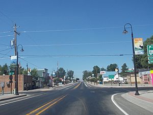
Mount Vernon is situated in eastern Oregon. It is located along U.S. Route 26, a major highway. The city sits right next to the John Day River. This river is known for its beautiful scenery and fishing opportunities.
The city is about 8 miles (13 km) west of the city of John Day. According to the United States Census Bureau, Mount Vernon covers a total area of 0.68 square miles (1.77 square kilometers). All of this area is land, with no large bodies of water inside the city limits.
Population and People
The population of Mount Vernon has changed over the years. A census is an official count of how many people live in a place. The United States government does a census every ten years.
| Historical population | |||
|---|---|---|---|
| Census | Pop. | %± | |
| 1950 | 451 | — | |
| 1960 | 502 | 11.3% | |
| 1970 | 423 | −15.7% | |
| 1980 | 569 | 34.5% | |
| 1990 | 538 | −5.4% | |
| 2000 | 595 | 10.6% | |
| 2010 | 527 | −11.4% | |
| 2020 | 548 | 4.0% | |
| U.S. Decennial Census | |||
Population in 2010
In 2010, the census showed that 527 people lived in Mount Vernon. There were 259 households, which are groups of people living together in one home. About 151 of these households were families.
The city had 281 housing units, which are places where people can live. Most of the people living in Mount Vernon were White (95.4%). A small number of residents were Native American, Asian, or from other backgrounds. About 3.0% of the population identified as Hispanic or Latino.
About 21.2% of households had children under 18 living with them. Many households (44.4%) were married couples. The average household had 2.03 people, and the average family had 2.61 people.
The average age of people in Mount Vernon in 2010 was 49 years old. About 19.7% of residents were under 18. Also, 22.2% of residents were 65 years old or older. The population was almost evenly split between males (49.7%) and females (50.3%).
See also
 In Spanish: Mount Vernon (Oregón) para niños
 | Laphonza Butler |
 | Daisy Bates |
 | Elizabeth Piper Ensley |


