Allagash Lake facts for kids
Quick facts for kids Allagash Lake |
|
|---|---|

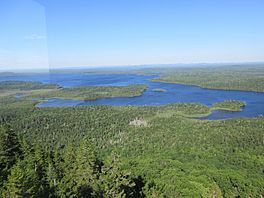
Allagash Lake from the summit of Allagash Mountain
|
|
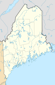
| Location | Piscataquis County, Maine |
| Coordinates | 46°19′13″N 69°31′40″W / 46.32028°N 69.52778°W |
| Primary inflows | Allagash Stream |
| Primary outflows | Allagash Stream |
| Basin countries | United States |
| Max. length | 4.4 mi (7.1 km) |
| Max. width | 1.6 mi (2.6 km) |
| Surface area | 4,260 acres (1,720 ha) |
| Average depth | 35 feet (11 m) |
| Max. depth | 89 feet (27 m) |
| Water volume | 151,374 acre⋅ft (186,717,000 m3) |
| Shore length1 | 23.8 miles (38.3 km) |
| Surface elevation | 1,037 ft (316 m) |
| 1 Shore length is not a well-defined measure. | |
Allagash Lake is a beautiful lake located in the northern part of Maine, a state in the United States. It's a special place known for its clear waters and the fish that live there. The lake is part of a large, wild area called the North Maine Woods.
Contents
All About Allagash Lake
Where is Allagash Lake?
Allagash Lake is found in a very wild and natural area of northern Maine. This region is often called the North Maine Woods, which is a huge forest area with many lakes and rivers. The lake sits right on the border of two land divisions, known as townships 7 and 8 in range 14.
How Water Flows In and Out
The main water source for Allagash Lake is a stream called Allagash Stream. This stream flows into the lake from its northwest side. The water comes from other smaller ponds like Allagash Pond, Crescent Pond, and Mud Pond.
Allagash Stream also flows out of Allagash Lake from its northeast corner. From there, the stream travels about 5 miles (8.0 km) through a smaller body of water called Little Round Pond. Eventually, this water reaches Chamberlain Lake.
A Change in Water Flow
Long ago, in the 1850s, the water from Chamberlain Lake used to flow into Eagle Lake and Churchill Lake, and then into the Allagash River. However, engineers created a new channel called Telos Cut. This channel changed the direction of the water. Now, water from Chamberlain Lake flows into the Penobscot River instead.
Fish and Wildlife
Allagash Lake is a great home for certain types of fish. It has a good environment for togue, which are also known as lake trout. It's also a good spot for squaretail, which is another name for brook trout. These fish thrive in the lake's clean and deep waters.


