Chamberlain Lake facts for kids
Quick facts for kids Chamberlain Lake |
|
|---|---|
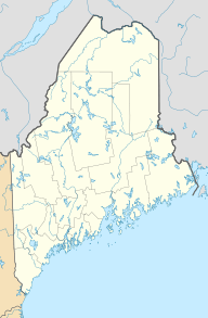
| Location | Piscataquis County, Maine |
| Coordinates | 46°13′N 69°18′W / 46.217°N 69.300°W |
| Primary outflows | Webster Brook |
| Basin countries | United States |
| Max. length | 14 mi (23 km) |
| Max. width | 2 mi (3.2 km) |
| Surface area | 10,932 acres (4,424 ha) |
| Max. depth | 154 feet (47 m) |
| Water volume | 473,380 acre⋅ft (583,910,000 m3) |
| Surface elevation | 942 ft (287 m) |
Chamberlain Lake is one of the biggest and deepest lakes in the North Maine Woods. It's a really important natural area in Maine, USA.
Long ago, the lake's water naturally flowed north. It went through Eagle Lake and Churchill Lake. From there, it joined the Allagash River, which eventually reached the Saint John River.
But in the 1800s, people changed how the lake drained. This was done for logging. The lake's water was redirected to flow into the Penobscot River instead. This change happened before the Allagash Wilderness Waterway was created in 1966.
A Lake Transformed: How Chamberlain Lake Changed
For many years, Telos Lake flowed into the southern part of Chamberlain Lake. But in 1841, workers dug a new channel. This channel was called the Telos Cut. It made Telos Lake drain in a different direction. Its water then flowed east into Webster Lake and towards the Penobscot River.
Later, in the 1850s, a man named Eben S. Coe built a special dam. It was called the Lock Dam and was made of timber. This dam was built across the place where Chamberlain Lake's water flowed out. The dam caused Chamberlain Lake to overflow its banks.
The overflowing water then moved south. It passed through Round Pond, Telos Lake, and Webster Lake. Finally, it reached Webster Brook, which flows into the East Branch Penobscot River in Baxter State Park.
These big changes helped loggers. They could now float logs from the upper Saint John River area. The logs would travel all the way to sawmills in Bangor. Today, the water levels of Chamberlain Lake, Round Pond, and Telos Lake are controlled by the Telos Dam.
Fish and Wildlife in Chamberlain Lake
Chamberlain Lake is a great home for many fish. In the summer, the water near the surface is about 64°F (18°C). But in the deepest parts, it's much colder, around 52°F (11°C). This cold water has lots of dissolved oxygen. This is perfect for fish like lake trout, also known as togue.
Togue need stable water levels in the fall. This is when they lay their eggs in the rocky, shallow areas. The main food for togue in Chamberlain Lake is Lake whitefish and round whitefish. The lake also has healthy populations of brook trout.
 | Madam C. J. Walker |
 | Janet Emerson Bashen |
 | Annie Turnbo Malone |
 | Maggie L. Walker |


