Chamberlain Basin facts for kids
Quick facts for kids Chamberlain Basin |
|
|---|---|

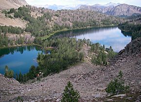
Chamberlain Basin lakes number 8 and 9
|
|
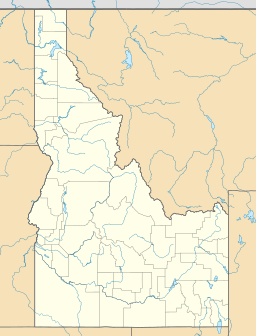
| Location | Custer County, Idaho |
| Coordinates | 44°01′43″N 114°36′01″W / 44.0285222°N 114.6003429°W |
| Type | Glacial |
| Primary outflows | Chamberlain Creek to Germania Creek |
| Basin countries | United States |
| Max. length | 4.8 mi (7.7 km) |
| Surface elevation | 9,396 ft (2,864 m) |
Chamberlain Basin is a beautiful area in Custer County, Idaho, United States. It's known for its chain of ten amazing lakes. These lakes are high up in the mountains and were formed by glaciers long ago. You can find this special place in the White Cloud Mountains, which are part of the Sawtooth National Recreation Area.
The lakes in Chamberlain Basin are called "Paternoster lakes." This means they are connected by a single stream, like beads on a rosary. The water from these lakes flows into Chamberlain Creek. This creek then joins Germania Creek, which eventually flows into the East Fork Salmon River.
Exploring Chamberlain Basin
Chamberlain Basin is a popular spot for hikers and nature lovers. It's surrounded by tall mountains and offers stunning views.
Mountain Peaks and Trails
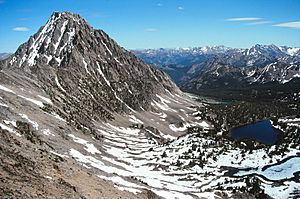
The highest mountain in the White Cloud Mountains is Castle Peak. It stands tall to the east and north of Chamberlain Basin. This impressive peak adds to the amazing scenery of the area.
A hiking trail, called Sawtooth National Forest trail 047, goes through the basin. Many people start their adventure to Chamberlain Basin from the Fourth of July Creek trailhead. This trail allows visitors to explore the beautiful lakes and mountain landscapes.
The Ten Lakes of Chamberlain Basin
There are ten main lakes in Chamberlain Basin. They don't have official names, so they are simply numbered from 1 to 10. Lake 1 is the lowest in elevation, and Lake 10 is the highest. These lakes were created by glaciers that moved through the area thousands of years ago.
Here is a list of the lakes, showing their elevation and approximate size:
| Lake | Elevation | Max. length | Max. width | Location |
|---|---|---|---|---|
| Chamberlain Lake 1 | 2,804 m (9,199 ft) | 109 m (358 ft) | 88 m (289 ft) | 44°01′27″N 114°35′19″W / 44.024244°N 114.588538°W |
| Chamberlain Lake 2 | 2,808 m (9,213 ft) | 407 m (1,335 ft) | 175 m (574 ft) | 44°01′36″N 114°35′34″W / 44.026686°N 114.592728°W |
| Chamberlain Lake 3 | 2,826 m (9,272 ft) | 90 m (300 ft) | 54 m (177 ft) | 44°01′28″N 114°35′49″W / 44.024487°N 114.597014°W |
| Chamberlain Lake 4 | 2,827 m (9,275 ft) | 95 m (312 ft) | 55 m (180 ft) | 44°01′25″N 114°35′56″W / 44.023507°N 114.598931°W |
| Chamberlain Lake 5 | 2,827 m (9,275 ft) | 183 m (600 ft) | 117 m (384 ft) | 44°01′15″N 114°35′42″W / 44.020811°N 114.595077°W |
| Chamberlain Lake 6 | 2,862 m (9,390 ft) | 69 m (226 ft) | 54 m (177 ft) | 44°01′43″N 114°35′57″W / 44.028749°N 114.599065°W |
| Chamberlain Lake 7 | 2,890 m (9,480 ft) | 38 m (125 ft) | 32 m (105 ft) | 44°01′49″N 114°36′13″W / 44.030225°N 114.603694°W |
| Chamberlain Lake 8 | 2,893 m (9,491 ft) | 461 m (1,512 ft) | 248 m (814 ft) | 44°02′02″N 114°36′14″W / 44.033944°N 114.603881°W |
| Chamberlain Lake 9 | 2,899 m (9,511 ft) | 182 m (597 ft) | 116 m (381 ft) | 44°02′12″N 114°36′19″W / 44.036604°N 114.605169°W |
| Chamberlain Lake 10 | 3,007 m (9,865 ft) | 372 m (1,220 ft) | 113 m (371 ft) | 44°02′17″N 114°36′37″W / 44.038140°N 114.610143°W |
 | James B. Knighten |
 | Azellia White |
 | Willa Brown |


