
Alleyton, Texas facts for kids
Quick facts for kids
Alleyton, Texas
|
|
|---|---|

Alleyton, Texas
Location in Texas

Alleyton, Texas
Location in the United States
|
|
| Country | United States |
| State | Texas |
| County | Colorado |
| Elevation | 188 ft (57 m) |
| Time zone | UTC-6 (Central (CST)) |
| • Summer (DST) | UTC-5 (CDT) |
| ZIP code |
78935
|
| Area code(s) | 979 |
Alleyton is a small, unincorporated community in the middle of Colorado County, Texas. An "unincorporated community" means it's a place where people live, but it doesn't have its own local government like a city or town. In the year 2000, about 165 people lived there.
Contents
History of Alleyton
Early Settlement
Alleyton was first settled in 1821 by Rawson Alley. Before that, it was a place where Native American tribes camped. Rawson's brothers, including William A. Alley, Jr., joined him in 1822.
In 1859, William Alley gave land for a new railroad to be built. He also helped build stores, a roundhouse (a building for trains), a station, and places to load goods. He made sure the Buffalo Bayou, Brazos, and Colorado Railway came to his land.
Railroad Town
When the railroad was finished in 1860, Alleyton became the end of the southernmost railroad in Texas. This made Alleyton the biggest and busiest town in Colorado County for a while. A post office opened there in 1860.
During the American Civil War, Alleyton was very important. It was the start of the "cotton road." This was a route where wagons carried cotton from Texas all the way to Mexico. This helped Texas avoid the Union blockade, which stopped ships from entering or leaving Texas ports. Wagons also brought military and other supplies back to Alleyton. These supplies were then sent by train to other Confederate states.
Changes Over Time
After the Civil War, the railroad was extended across the Colorado River to Columbus and other towns. Alleyton became less important as a main railroad center. However, it was still a key place for supplies in a busy farming area.
By 1890, Alleyton had two churches, five general stores, a drugstore, and a saloon. About 200 people lived there. The population grew to 320 by 1896, but then it started to shrink. It stayed around 200 people until the 1940s.
In the early 1900s, farmers in Alleyton mainly grew cotton. They also grew some rice, corn, and pecans. Large-scale strip mining for gravel near the river created many lakes that are now popular for fishing. But this mining also destroyed some good farmland.
After World War II, more people started wearing clothes made from man-made materials instead of cotton. Also, the government put more rules on cotton farming. Because of these changes, Alleyton's population dropped to about 125 by the 1950s. By 1986, only 65 people lived there. There were still a few businesses, like an auto salvage yard and a welding service. In 2000, the population was 165.
Geography
Alleyton is located on the east side of the Colorado River. It is on Farm to Market Road 102, between Interstate 10 and the main railroad line. It is about 3 miles (5 km) east of Columbus, Texas. It used to be on Texas State Highway 73.
Education
Alleyton had its own school in 1890. Today, students in Alleyton attend schools in the Columbus Independent School District.
Notable people
- Shelly Lee Alley, a musician and songwriter
- Joseph J. Mansfield, a member of the United States House of Representatives (a group of elected officials who make laws for the country).
Gallery
-
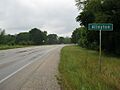
Alleyton road sign on FM 102 looking north
-

Historical marker explains the town's role in the US Civil War


