Alta, Indiana facts for kids
Quick facts for kids
Alta, Indiana
|
|
|---|---|

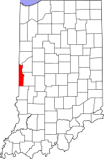
Vermillion County's location in Indiana
|
|
| Country | United States |
| State | Indiana |
| County | Vermillion |
| Township | Helt |
| Elevation | 502 ft (153 m) |
| Time zone | UTC-5 (Eastern (EST)) |
| • Summer (DST) | UTC-4 (EDT) |
| ZIP code |
47854
|
| Area code(s) | 765 |
| GNIS feature ID | 430118 |
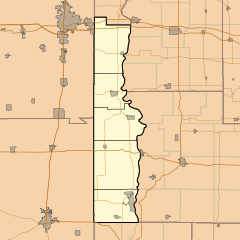
Alta is a small, quiet place in Indiana. It's called an unincorporated community. This means it's a group of homes and buildings that isn't officially a town or city. Alta is located in Vermillion County, within Helt Township.
Contents
The Story of Alta
How Alta Got Started
Alta was first planned out in 1871. When a place is "laid out," it means people decided where streets and buildings would go. It was like drawing a map for a new small community.
What Does "Alta" Mean?
The name "Alta" likely comes from a word meaning "elevation" or "high place." This might be because of its location.
Where is Alta Located?
Alta's Surroundings
Alta is easy to find in Vermillion County. It sits about half a mile west of the famous Wabash River. It is also about half a mile south of the town of Hillsdale.
Roads and Railways
You can find Alta around where county roads 775 South and 400 East meet. A CSX railroad line also runs just east of Alta. This line goes from north to south.
 | Emma Amos |
 | Edward Mitchell Bannister |
 | Larry D. Alexander |
 | Ernie Barnes |


