Alto Sano, Las Marías, Puerto Rico facts for kids
Quick facts for kids
Alto Sano
|
|
|---|---|
|
Barrio
|
|

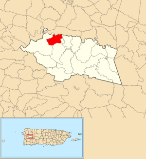
Location of Alto Sano within the municipality of Las Marías shown in red
|
|
| Commonwealth | |
| Municipality | |
| Area | |
| • Total | 1.64 sq mi (4.2 km2) |
| • Land | 1.63 sq mi (4.2 km2) |
| • Water | 0.01 sq mi (0.03 km2) |
| Elevation | 466 ft (142 m) |
| Population
(2010)
|
|
| • Total | 179 |
| • Density | 109.1/sq mi (42.1/km2) |
| Source: 2010 Census | |
| Time zone | UTC−4 (AST) |
Alto Sano is a small community, or barrio, located in the town of Las Marías, Puerto Rico. In 2010, about 179 people lived there.
A Look Back in Time
After the Spanish–American War ended in 1898, Spain gave Puerto Rico to the United States. This made Puerto Rico an unincorporated territory of the U.S. This means it's a part of the U.S. but doesn't have all the same rights as a state.
In 1899, the United States Department of War counted all the people in Puerto Rico. This count, called a census, showed that 885 people lived in Alto Sano at that time.
| Historical population | |||
|---|---|---|---|
| Census | Pop. | %± | |
| 1900 | 885 | — | |
| 1980 | 110 | — | |
| 1990 | 148 | 34.5% | |
| 2000 | 145 | −2.0% | |
| 2010 | 179 | 23.4% | |
| U.S. Decennial Census 1899 (shown as 1900) 1910-1930 1930-1950 1980-2000 2010 |
|||
Parts of Alto Sano
In Puerto Rico, barrios are often divided into smaller areas called sectores (pronounced: sek-TOR-es). These are like smaller neighborhoods or sections within a larger community.
The types of sectores can be different. Some are simply called sector, while others might be named urbanización (a planned housing area), reparto (a land division), barriada (a neighborhood), or residencial (a residential complex).
Alto Sano barrio includes the following sector:
- Sector Alto Sano Interior
See also
 In Spanish: Alto Sano (Las Marías) para niños
- List of communities in Puerto Rico
- List of barrios and sectors of Las Marías, Puerto Rico
 | Tommie Smith |
 | Simone Manuel |
 | Shani Davis |
 | Simone Biles |
 | Alice Coachman |


