Altoona, Alabama facts for kids
Quick facts for kids
Altoona
|
|
|---|---|

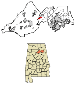
Location of Altoona in Blount County and Etowah County, Alabama.
|
|
| Country | United States |
| State | Alabama |
| Counties | Etowah, Blount |
| Area | |
| • Total | 4.49 sq mi (11.63 km2) |
| • Land | 4.48 sq mi (11.60 km2) |
| • Water | 0.01 sq mi (0.03 km2) |
| Elevation | 942 ft (287 m) |
| Population
(2020)
|
|
| • Total | 948 |
| • Density | 211.61/sq mi (81.70/km2) |
| Time zone | UTC-6 (CST) |
| • Summer (DST) | UTC-5 (CDT) |
| ZIP code |
35952
|
| Area codes | 205, 659 |
| FIPS code | 01-01660 |
| GNIS feature ID | 2405146 |
Altoona is a small town in the state of Alabama, in the United States. It is mostly located in Etowah County, but a small part of it is in Blount County. Altoona is part of the larger Gadsden Metropolitan Statistical Area. In 2020, about 948 people lived there.
Contents
A Look Back: Altoona's History
Altoona started as a mining town in the year 1900. It was named after another town known for coal mining, Altoona, Pennsylvania. The town got its first post office in 1900. Altoona officially became an incorporated town in 1908.
Where is Altoona? (Geography)
Altoona is located in the western part of Etowah County. A small section of the town also reaches into Blount County. The town sits in a place called Murphree Valley, right at the bottom of Altoona Mountain. There's also a narrow hill called Straight Mountain that runs almost through the middle of the town.
A main road, Alabama State Route 132 (also known as Main Street), goes southwest about 10 miles (16 km) to Oneonta. Oneonta is the main town for Blount County. This road also goes northeast towards Gadsden if you take U.S. Route 278.
The town covers a total area of about 4.49 square miles (11.63 square kilometers). Only a tiny part of this area, about 0.23%, is water.
Who Lives in Altoona? (Population)
The population of Altoona has changed over the years. A U.S. Census is a count of all the people living in the country, done every ten years.
| Historical population | |||
|---|---|---|---|
| Census | Pop. | %± | |
| 1910 | 1,071 | — | |
| 1920 | 1,078 | 0.7% | |
| 1930 | 1,098 | 1.9% | |
| 1940 | 995 | −9.4% | |
| 1950 | 860 | −13.6% | |
| 1960 | 744 | −13.5% | |
| 1970 | 781 | 5.0% | |
| 1980 | 928 | 18.8% | |
| 1990 | 960 | 3.4% | |
| 2000 | 984 | 2.5% | |
| 2010 | 933 | −5.2% | |
| 2020 | 948 | 1.6% | |
| U.S. Decennial Census | |||
Altoona first appeared as an official town in the 1910 U.S. Census.
Understanding Altoona's Census Areas
| Historical population | |||
|---|---|---|---|
| Census | Pop. | %± | |
| 1910 | 1,158 | — | |
| 1920 | 1,202 | 3.8% | |
| 1930 | 1,316 | 9.5% | |
| 1940 | 1,187 | −9.8% | |
| 1950 | 1,014 | −14.6% | |
| 1960 | 3,661 | 261.0% | |
| 1970 | 3,401 | −7.1% | |
| 1980 | 3,976 | 16.9% | |
| 1990 | 4,390 | 10.4% | |
| 2000 | 5,127 | 16.8% | |
| 2010 | 5,302 | 3.4% | |
| U.S. Decennial Census | |||
The Altoona Precinct (which was Etowah County's 32nd Precinct) first showed up in the 1910 U.S. Census. In 1960, it was renamed the Altoona Census Division. This change happened as counties were reorganized. The census division only includes the part of Altoona that is in Etowah County. The part of Altoona in Blount County is counted in a different area called the Clarence Census Division.
See also
 In Spanish: Altoona (Alabama) para niños
 | Emma Amos |
 | Edward Mitchell Bannister |
 | Larry D. Alexander |
 | Ernie Barnes |


