Ambia, Indiana facts for kids
Quick facts for kids
Ambia, Indiana
|
|
|---|---|
 |
|
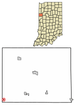
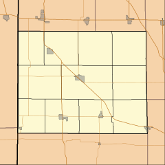
Location of Ambia in Benton County, Indiana.
|
|
| Country | United States |
| State | Indiana |
| County | Benton |
| Township | Hickory Grove |
| Founded | 1875 |
| Area | |
| • Total | 0.15 sq mi (0.39 km2) |
| • Land | 0.15 sq mi (0.39 km2) |
| • Water | 0.00 sq mi (0.00 km2) |
| Elevation | 738 ft (225 m) |
| Population
(2020)
|
|
| • Total | 227 |
| • Density | 1,503.31/sq mi (580.60/km2) |
| Time zone | UTC-5 (EST) |
| • Summer (DST) | UTC-4 (EDT) |
| ZIP code |
47917
|
| Area code | 765 |
| FIPS code | 18-01342 |
| GNIS ID | 2397427 |
Ambia is a small town in Benton County, Indiana, United States. It is located within Hickory Grove Township. In 2020, about 227 people lived here. Ambia is also part of the Lafayette, Indiana Metropolitan Statistical Area.
Contents
History of Ambia
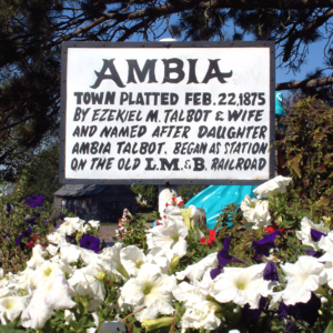
Ambia was officially started on February 22, 1875. It was founded by Ezekiel M. Talbot and his wife, Marietta. They named the town after their daughter, Ambia Talbot. Just two years before, they had also planned the nearby town of Talbot.
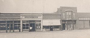
The very first building in Ambia was a house built by James C. Pugh. Soon after, more businesses opened, like a place to store grain, a general store, and a blacksmith shop. Over time, the town grew to include a drug store, a hardware store, a hotel, and even a doctor's office.
How the Railroad Helped Ambia Grow
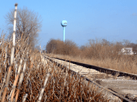
Ambia became an important stop on the Lafayette, Muncie and Bloomington Railroad. This railway line later became known as the Lake Erie and Western. It connected the cities of Lafayette and Hoopeston.
There's an interesting story about how Ambia got its start. The railway company originally wanted to build a train switch at a small town called Weaver City, which was just west of Ambia in Illinois. However, the owner of the land in Weaver City would not let them build there.
So, on a Sunday morning, March 10, 1873, the railway officials decided to take action. They sent a group of workers to move the entire train station house from Weaver City! They moved it about half a mile east, right across the state border into Indiana. After the station moved, many of the businesses and people from Weaver City followed it to the new location. This caused Weaver City to disappear, and Ambia quickly grew up around the new train station site.
Geography of Ambia
Ambia is located in the very southwest corner of Benton County. The Kankakee, Beaverville and Southern Railroad and Indiana State Road 352 both pass through the town. A part of the Vermilion River, called the North Fork, flows about one mile north of Ambia.
According to the 2010 census, Ambia covers a total area of about 0.15 square miles (0.39 square kilometers). All of this area is land.
Population Information
| Historical population | |||
|---|---|---|---|
| Census | Pop. | %± | |
| 1880 | 253 | — | |
| 1890 | 293 | 15.8% | |
| 1900 | 438 | 49.5% | |
| 1910 | 359 | −18.0% | |
| 1920 | 459 | 27.9% | |
| 1930 | 433 | −5.7% | |
| 1940 | 603 | 39.3% | |
| 1950 | 356 | −41.0% | |
| 1960 | 351 | −1.4% | |
| 1970 | 300 | −14.5% | |
| 1980 | 274 | −8.7% | |
| 1990 | 249 | −9.1% | |
| 2000 | 197 | −20.9% | |
| 2010 | 239 | 21.3% | |
| 2020 | 227 | −5.0% | |
| U.S. Decennial Census | |||
Ambia's Population in 2010
The 2010 census counted 239 people living in Ambia. There were 78 households, and 63 of these were families. The town had about 1593 people per square mile.
Many households (50%) had children under 18 living with them. Most families (66.7%) were married couples living together. The average household had about 3 people, and the average family had almost 3.5 people.
The average age of people in Ambia was 31.4 years old. About 34% of the residents were under 18. About half of the population was male (50.6%) and half was female (49.4%).
See also
 In Spanish: Ambia (Indiana) para niños


