Amorita, Oklahoma facts for kids
Quick facts for kids
Amorita, Oklahoma
|
|
|---|---|

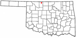
Location of Amorita, Oklahoma
|
|
| Country | United States |
| State | Oklahoma |
| County | Alfalfa |
| Area | |
| • Total | 0.25 sq mi (0.65 km2) |
| • Land | 0.25 sq mi (0.65 km2) |
| • Water | 0.00 sq mi (0.00 km2) |
| Elevation | 1,207 ft (368 m) |
| Population
(2020)
|
|
| • Total | 38 |
| • Density | 150.20/sq mi (58.07/km2) |
| Time zone | UTC-6 (Central (CST)) |
| • Summer (DST) | UTC-5 (CDT) |
| ZIP code |
73719
|
| Area code(s) | 580 |
| FIPS code | 40-02000 |
| GNIS feature ID | 2412362 |
Amorita is a small town in Alfalfa County, Oklahoma, in the United States. In 2020, 38 people lived there.
Contents
History of Amorita
Amorita was started in September 1901. People think it was named after the wife of Charles E. Ingersoll, who owned a railroad. When the town began, it was part of a much bigger area called Woods County. It became part of Alfalfa County in 1907, when Oklahoma became a state.
Railroad and Early Growth
The town was built in 1901 by the Choctaw Northern Railroad. This railroad later became part of the Chicago, Rock Island and Pacific Railroad. Amorita was about two miles north of the town of Byron. The railroad was the first in the county. It connected Amorita to other towns like Aline, Augusta, Ingersoll, Lambert, and Driftwood. It also went into Kansas.
Land lots in Amorita were sold when the railroad finished its tracks in November 1901. At first, not many lots were sold. But within a month, a butcher shop and a coal and grain business opened. By February of the next year, two grain elevators were also built. Farming was the main way people made a living in the area. Amorita became an important place for transportation because nearby Byron did not get its own railroad until October 1902.
Town Development and Changes
Residents of Amorita voted to make their town an official town in May 1912. In 1919, people approved money to build a new school. This school would serve Amorita and two other school areas. In 1921, voters in both Byron and Amorita agreed to build power lines from Kansas. These lines would bring electricity to both towns.
The railroad stopped using its tracks through Amorita in 1936. In the 1960s, the Amorita school joined with schools from Burlington, Byron, and Driftwood. The new combined school was located in Burlington.
Geography of Amorita
Amorita is located along State Highway 58. It is between the town of Byron to the south and the Kansas border to the north.
The town covers a total area of about 0.65 square kilometers (0.25 square miles). All of this area is land. The town has about 58 people living in each square kilometer.
Population and People
| Historical population | |||
|---|---|---|---|
| Census | Pop. | %± | |
| 1920 | 196 | — | |
| 1930 | 194 | −1.0% | |
| 1940 | 208 | 7.2% | |
| 1950 | 125 | −39.9% | |
| 1960 | 74 | −40.8% | |
| 1970 | 63 | −14.9% | |
| 1980 | 66 | 4.8% | |
| 1990 | 56 | −15.2% | |
| 2000 | 44 | −21.4% | |
| 2010 | 37 | −15.9% | |
| 2020 | 38 | 2.7% | |
| U.S. Decennial Census | |||
Amorita's Population in 2010
In 2010, there were 37 people living in Amorita. There were 19 houses or places to live in the town.
Most of the people in Amorita were White (about 84%). Some were African American (about 7%), and some were Native American (about 5%). A small number of people were from two or more races (about 5%). About 2% of the population was Hispanic or Latino.
There were 14 households in the town. About 23% of these households had children under 18 living with them. About 45% were married couples living together. About 14% had a female head of household with no husband present. About 36% of households were made up of single individuals. Of these, about 27% had someone aged 65 or older living alone. The average household had 2 people.
The population was spread out by age. About 23% were under 18 years old. About 7% were 18 to 24 years old. About 18% were 25 to 44 years old. About 23% were 45 to 64 years old. And about 30% were 65 years or older. The average age in the town was 46 years.
See also
 In Spanish: Amorita (Oklahoma) para niños
 | Ernest Everett Just |
 | Mary Jackson |
 | Emmett Chappelle |
 | Marie Maynard Daly |

