Amtali Upazila facts for kids
Quick facts for kids
Amtali
আমতলী
|
|
|---|---|
 |
|
| Country | |
| Division | Barisal Division |
| District | Barguna District |
| Area | |
| • Total | 386.92 km2 (149.39 sq mi) |
| Population
(2022)
|
|
| • Total | 214,436 |
| • Density | 554.213/km2 (1,435.404/sq mi) |
| Time zone | UTC+6 (BST) |
| Website | Official Map of the Amtali Upazila: http://lib.pmo.gov.bd/maps/images/barguna/Amtali.gif |
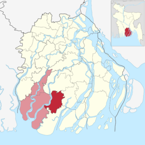
Amtali (Bengali: আমতলী) is a special type of area called an upazila in Bangladesh. It's located in the Barguna District, which is part of the Barisal Division. Amtali is a coastal area, meaning it's near the sea.
Contents
Geography of Amtali
Amtali is found at specific coordinates: 22.1294° N (North) and 90.2289° E (East). It covers a total area of 695 square kilometers. A large part of this area, about 212 square kilometers, is made up of water bodies like rivers and canals. There are 45,804 households, which are homes where families live.
People and Population
| Historical population | ||
|---|---|---|
| Year | Pop. (000) | ±% |
| 1981 | 232 | — |
| 1991 | 244 | +5.2% |
| 2001 | 260 | +6.6% |
| 2011 | 271 | +4.2% |
| Source: Bangladesh Bureau of Statistics |
||
| Religions in Amtali upazila (2011) | ||||
|---|---|---|---|---|
| Religion | Percent | |||
| Islam | 94.29% | |||
| Hinduism | 5.69% | |||
| Other or not stated | 0.02% | |||
According to the 2011 Bangladesh census, Amtali had a population of 182,798 people. These people lived in 42,201 households. About 11.93% of the population, or 21,808 people, lived in urban areas.
Education and Gender Balance
The average literacy rate in Amtali was 51.73% for people aged 7 and older. This means more than half of the people could read and write. The sex ratio was 1066 females for every 1000 males. This shows there were slightly more females than males.
How Amtali is Governed
Amtali Upazila is managed by a special officer called the UNO, which stands for Upazila Nirbahi Officer. The current UNO is Md. Ashraful Alam.
Local Divisions
Amtali Upazila is divided into smaller parts to help with its administration. These parts include Amtali Municipality and seven union parishads. A union parishad is a type of local council that manages rural areas.
The seven union parishads are:
- Amtali
- Arpangasia
- Atharogasia
- Chawra
- Gulishakhali
- Holodia
- Kukua
Amtali Municipality is further divided into 9 wards and 14 mahallas. Wards and mahallas are smaller areas within a town or city, used for local government.
See also
 In Spanish: Amtali para niños
 | Shirley Ann Jackson |
 | Garett Morgan |
 | J. Ernest Wilkins Jr. |
 | Elijah McCoy |

