Anaktuvuk River facts for kids
Quick facts for kids Anaktuvuk River |
|
|---|---|

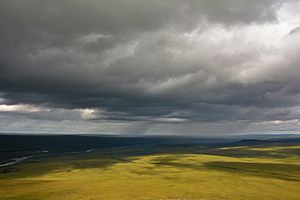
The Anaktuvuk River winds through the sweeping tundra hills of Alaska's North Slope region.
|
|
|
Location of the mouth of the Anaktuvuk River in Alaska
|
|
| Native name | Anaqtuuvak |
| Country | United States |
| State | Alaska |
| Borough | North Slope |
| Physical characteristics | |
| Main source | Fan Mountain glacier 6,019 ft (1,835 m) 68°08′48″N 150°58′31″W / 68.14667°N 150.97528°W |
| River mouth | Colville River near Umiat 153 ft (47 m) 69°30′47″N 151°26′39″W / 69.51306°N 151.44417°W |
| Length | 135 mi (217 km) |
The Anaktuvuk River (in Iñupiaq, Anaqtuuvak) is a long river in Alaska's North Slope region. It stretches about One hundred and thirty-five miles (217 km) (217 kilometers) from its start to where it ends.
This river begins high up in the Endicott Mountains, flowing from melting glaciers. It first flows west, then turns north near Anaktuvuk Pass. The river continues north until it reaches the Arctic Coastal Plain. There, it joins the larger Colville River.
The Anaktuvuk River gets its water from several glaciers. These include glaciers on Fan Mountain, Alapah Mountain, and Limestack Mountain. Limestack Mountain is special because it sits on a divide. This means water from one side flows to the Arctic Coastal Plain, and water from the other side goes to the Koyukuk River. Graylime Creek helps carry water from Limestack Mountain to the Anaktuvuk River.
The John River is the first major stream that flows into the Anaktuvuk River. Later, the Nanushuk River also joins it.
In 1901, two explorers from the United States Geological Survey (USGS) traveled down the Anaktuvuk River. Geologist F.C. Schrader and topographer W.J. Peters used canoes to explore the river. They were the first to map this part of the Arctic Slope. Later, in 1938, Robert "Bob" Marshall also explored where the river begins.
Exploring the Anaktuvuk River
The Anaktuvuk River is often very shallow. This makes it hard for motorboats to travel on most parts of it. However, some areas are great for fishing. You can find Arctic char and large "monster grayling" fish here.
Hunters sometimes fly into the Anaktuvuk River area during summer. They look for animals like moose, bears, and caribou. Because the river's water levels change a lot and it's very far away, it's not a common place for people to go boating for fun. The weather can also be very challenging.
Wildlife Along the River
The Anaktuvuk River is in a very wild and untouched area. This means it's a great place for many animals to live. Along the middle and lower parts of the river, there are some shrub forests. These small forests provide important homes for moose. Moose are not often found in other parts of the largely treeless North Slope.
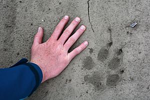
Many other animals also live in the Anaktuvuk River area. You can find grizzly bears, caribou, and wolves. There are also many small mammals. Birds that travel long distances, like yellow-billed loons and Canada geese, raise their young along the river's banks.
 | Kyle Baker |
 | Joseph Yoakum |
 | Laura Wheeler Waring |
 | Henry Ossawa Tanner |


