Antwerp, Ohio facts for kids
Quick facts for kids
Antwerp, Ohio
|
|
|---|---|
|
Village
|
|

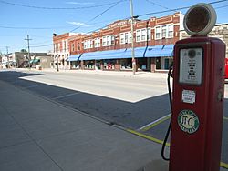
Main Street downtown
|
|

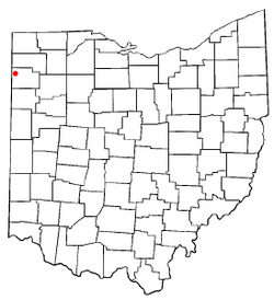
Location of Antwerp, Ohio
|
|

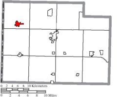
Location of Antwerp in Paulding County
|
|
| Country | United States |
| State | Ohio |
| County | Paulding |
| Township | Carryall |
| Area | |
| • Total | 1.33 sq mi (3.45 km2) |
| • Land | 1.33 sq mi (3.45 km2) |
| • Water | 0.00 sq mi (0.00 km2) |
| Elevation | 728 ft (222 m) |
| Population
(2020)
|
|
| • Total | 1,676 |
| • Estimate
(2023)
|
1,681 |
| • Density | 1,258.26/sq mi (485.76/km2) |
| Time zone | UTC-5 (Eastern (EST)) |
| • Summer (DST) | UTC-4 (EDT) |
| ZIP code |
45813
|
| Area code(s) | 419 |
| FIPS code | 39-02204 |
| GNIS feature ID | 2397971 |
| Website | www.antwerpohio.com |
Antwerp is a small town, called a village, located in Paulding County, Ohio, in the United States. It sits right next to the Maumee River. In 2020, about 1,676 people lived there.
Antwerp is close to the Six Mile Reservoir. This was the location of a conflict called the Reservoir War in 1887. A famous checkers player named Asa Long was born in Antwerp. The village was named after the city of Antwerp in Belgium.
Contents
History of Antwerp
Antwerp is in an area that used to be a large wetland called the Great Black Swamp. This swamp covered much of northwest Ohio until the 1800s.
The village of Antwerp was started in 1841. It was built along the Wabash and Erie Canal, which was an important waterway. Later, when a railroad was built, the center of town moved to where it is today. The village got its name from the city of Antwerp in Belgium.
In the late 1800s, Antwerp was the biggest village in Paulding County. Its economy was strong because of the local logging and tile mill businesses. Logging meant cutting down trees for wood, and tile mills made tiles. Because of this, the Wabash, St. Louis and Pacific Railway built a very large train station in Antwerp. It was bigger than most other stations nearby.
The train station closed in 1976. A local historical group bought it to save it. Today, this old station is known as the Antwerp Norfolk and Western Depot. It is listed on the National Register of Historic Places, which means it's an important historical site.
Geography of Antwerp
Antwerp is about 1.33 square miles (3.45 square kilometers) in size. All of this area is land.
Population and People
| Historical population | |||
|---|---|---|---|
| Census | Pop. | %± | |
| 1870 | 717 | — | |
| 1880 | 1,275 | 77.8% | |
| 1890 | 1,331 | 4.4% | |
| 1900 | 1,206 | −9.4% | |
| 1910 | 1,187 | −1.6% | |
| 1920 | 1,096 | −7.7% | |
| 1930 | 1,024 | −6.6% | |
| 1940 | 1,086 | 6.1% | |
| 1950 | 1,162 | 7.0% | |
| 1960 | 1,465 | 26.1% | |
| 1970 | 1,735 | 18.4% | |
| 1980 | 1,765 | 1.7% | |
| 1990 | 1,677 | −5.0% | |
| 2000 | 1,740 | 3.8% | |
| 2010 | 1,736 | −0.2% | |
| 2020 | 1,676 | −3.5% | |
| 2023 (est.) | 1,681 | −3.2% | |
| U.S. Decennial Census | |||
Population in 2010
In 2010, there were 1,736 people living in Antwerp. These people lived in 752 homes. The village had about 1,305 people per square mile.
Most of the people living in Antwerp were White (96.6%). A small number were African American, Native American, or Asian. About 4.8% of the population identified as Hispanic or Latino.
About 32.8% of the homes had children under 18 living there. The average age of people in the village was about 37.9 years old.
Education in Antwerp
The Antwerp Local School District runs the schools in the village. There is one elementary school and Antwerp High School.
Antwerp also has a public library. It is a part of the Paulding County Carnegie Library system.
See also
 In Spanish: Antwerp (Ohio) para niños

