Apache–Sitgreaves National Forests facts for kids
Quick facts for kids Apache–Sitgreaves National Forest |
|
|---|---|
 |
|
| Location | Arizona and New Mexico, United States |
| Nearest city | Springerville |
| Area | 2,761,386 acres (11,174.93 km2) |
| Governing body | U.S. Forest Service |
| Website | Apache–Sitgreaves National Forest |
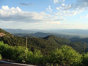
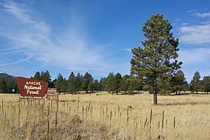
The Apache–Sitgreaves National Forests is a huge forest area in the United States. It stretches across east-central Arizona and into New Mexico. This forest is managed by the United States Forest Service. It's a popular spot for people from Phoenix, Arizona, especially in summer. They come to enjoy the cool weather and beautiful nature.
The forest is divided into five main areas called Ranger Districts. These districts cover almost 300 miles. The Apache–Sitgreaves National Forests are next to the Fort Apache Indian Reservation. They are found in several counties in Arizona and one in New Mexico.
Contents
Waterways and Lakes

The Apache–Sitgreaves National Forests have many lakes, rivers, and streams. There are eight main cold-water lakes. The forest also has over 680 miles of rivers and streams. Important rivers like the Black, Little Colorado, and San Francisco all start here.
Some of the lakes you can find are:
- Aker Lake
- Big Lake
- Woods Canyon Lake
- Willow Springs Lake
- Black Canyon Lake
- Chevelon Canyon Lake
- Luna Lake
- Bear Canyon Lake
- Crescent Lake
- Blue River
Special Wilderness Areas
The Apache–Sitgreaves National Forests are home to four special wilderness areas. These are places where nature is protected and kept wild. Three of these areas are officially recognized by the government. They are part of the National Wilderness Preservation System.
These wilderness areas include:
- Bear Wallow Wilderness
- Escudilla Wilderness
- Mount Baldy Wilderness
The fourth area is called the Blue Range Primitive Area. It was set aside in 1933 to keep its wild qualities. This area is managed to protect its natural state.
A Look Back in Time: Hannagan Meadow
About 18 miles southwest of Alpine, Arizona, you'll find the Hannagan Meadow area. It has a lodge, hiking trails, and a campground. This meadow was named after Robert Hannagan. He was a miner and cattle rancher.
There are a couple of stories about how the meadow got its name. One story says Hannagan was tied to a tree until a debt was paid. Another story says he and a rancher named Toles Cosper found the meadow in the 1870s. They flipped a coin to decide whose name it would get, and Hannagan won.
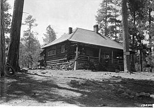
In 1909, a surveyor named John D. Guthrie noted that the meadow had no fences or cabins. But when the Coronado Trail Road was built, tourism became possible. Toles Cosper's son, DeWitt Cosper, built a lodge there in 1926. The Hannagan Meadow Lodge offered cabins, rooms, and a general store. It is still there today, serving visitors.
Climate in Hannagan Meadow
Hannagan Meadow has a climate with warm summers and cold winters. It experiences five seasons. Spring is usually the driest time of year. Summer is the wettest, with many thunderstorms. This is due to the North American Monsoon season.
Autumn brings cooler days, and winter usually starts in late November. Heavy snowfall is common during winter. The highest temperature ever recorded in Hannagan Meadows was 94°F (34°C). This happened on August 6, 2019. The lowest temperature recorded was -17°F (-27°C) on January 7, 1989.
 | Isaac Myers |
 | D. Hamilton Jackson |
 | A. Philip Randolph |


