Arrondissement of Angoulême facts for kids
Quick facts for kids
Arrondissement of Angoulême
|
|
|---|---|

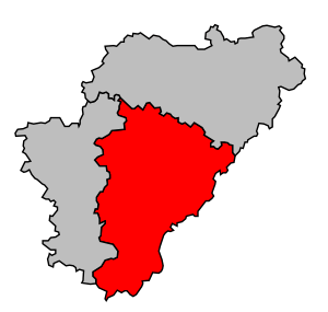
Location of Angoulême in Charente
|
|
| Country | France |
| Region | Nouvelle-Aquitaine |
| Department | Charente |
| Communes | 117 |
| Prefecture | Angoulême |
| INSEE code | 161 |
| Area | |
| • Total | 2,217.1 km2 (856.0 sq mi) |
| Population
(2014)
|
|
| • Total | 197,377 |
| • Density | 89.0249/km2 (230.573/sq mi) |
The arrondissement of Angoulême is a type of administrative area in France, like a county or district. It's located in the Charente department, which is part of the Nouvelle-Aquitaine region. The main city and capital of this area is Angoulême.
Contents
A Look Back: History of Angoulême Arrondissement
The Angoulême arrondissement was created a long time ago, in 1800. This was when the Charente department was first formed. It has been an important part of the region ever since.
Where is Angoulême? Geography and Size
The Angoulême arrondissement is the second largest district in the Charente department. It covers an area of about 2,217.1 km2 (856.0 sq mi). In 2014, about 197,377 people lived here. This means there were about 89.0 people living in each square kilometer.
This area is located in the southeastern part of Charente. To the north, it shares a border with the Confolens district. To the east and south, it borders the Dordogne department. To the west, it is next to the Cognac district.
Understanding the Arrondissement: How it's Organized
The Angoulême arrondissement is made up of different smaller areas. These include "cantons" and "communes."
Cantons: Local Divisions
After some changes in France, cantons are no longer just parts of one arrondissement. This means a canton can have towns (called "communes") that belong to different arrondissements.
In the Angoulême arrondissement, there are four cantons where not all their communes are within this specific district. These are Boixe-et-Manslois, Charente-Sud, Tude-et-Lavalette, and Val de Nouère.
Communes: The Towns and Villages
The Angoulême arrondissement has 117 communes. A commune is like a local town or village. Here is a list of these communes:
- Agris (16003)
- Angoulême (16015)
- Asnières-sur-Nouère (16019)
- Aubeterre-sur-Dronne (16020)
- Balzac (16026)
- Bardenac (16029)
- Bazac (16034)
- Bellon (16037)
- Bessac (16041)
- Blanzaguet-Saint-Cybard (16047)
- Bonnes (16049)
- Bors (16052)
- Bouëx (16055)
- Brie (16061)
- Brie-sous-Chalais (16063)
- Bunzac (16067)
- Chadurie (16072)
- Chalais (16073)
- Champniers (16078)
- Boisné-La Tude (16082)
- Charras (16084)
- Châtignac (16091)
- Chazelles (16093)
- Claix (16101)
- Combiers (16103)
- Coulgens (16107)
- Courgeac (16111)
- Courlac (16112)
- La Couronne (16113)
- Curac (16117)
- Deviat (16118)
- Dignac (16119)
- Dirac (16120)
- Écuras (16124)
- Édon (16125)
- Les Essards (16130)
- Eymouthiers (16135)
- Feuillade (16137)
- Fléac (16138)
- Fouquebrune (16143)
- Garat (16146)
- Gardes-le-Pontaroux (16147)
- Gond-Pontouvre (16154)
- Grassac (16158)
- Gurat (16162)
- L’Isle-d'Espagnac (16166)
- Jauldes (16168)
- Juignac (16170)
- Laprade (16180)
- Linars (16187)
- Magnac-Lavalette-Villars (16198)
- Magnac-sur-Touvre (16199)
- Mainzac (16203)
- Marillac-le-Franc (16209)
- Marsac (16210)
- Marthon (16211)
- Médillac (16215)
- Montboyer (16222)
- Montbron (16223)
- Montignac-le-Coq (16227)
- Montmoreau (16230)
- Mornac (16232)
- Mouthiers-sur-Boëme (16236)
- Nabinaud (16240)
- Nersac (16244)
- Nonac (16246)
- Orgedeuil (16250)
- Orival (16252)
- Palluaud (16254)
- Pillac (16260)
- Plassac-Rouffiac (16263)
- Poullignac (16267)
- Pranzac (16269)
- Puymoyen (16271)
- Rancogne (16274)
- Rioux-Martin (16279)
- Rivières (16280)
- La Rochefoucauld (16281)
- La Rochette (16282)
- Ronsenac (16283)
- Rouffiac (16284)
- Rougnac (16285)
- Roullet-Saint-Estèphe (16287)
- Rouzède (16290)
- Ruelle-sur-Touvre (16291)
- Saint-Adjutory (16293)
- Saint-Avit (16302)
- Saint-Germain-de-Montbron (16323)
- Saint-Laurent-des-Combes (16331)
- Saint-Martial (16334)
- Saint-Michel (16341)
- Saint-Projet-Saint-Constant (16344)
- Saint-Quentin-de-Chalais (16346)
- Saint-Romain (16347)
- Saint-Saturnin (16348)
- Saint-Séverin (16350)
- Saint-Sornin (16353)
- Saint-Yrieix-sur-Charente (16358)
- Salles-Lavalette (16362)
- Sers (16368)
- Sireuil (16370)
- Souffrignac (16372)
- Soyaux (16374)
- Taponnat-Fleurignac (16379)
- Torsac (16382)
- Touvre (16385)
- Trois-Palis (16388)
- Vaux-Lavalette (16394)
- Vilhonneur (16406)
- Villebois-Lavalette (16408)
- Vindelle (16415)
- Vœuil-et-Giget (16418)
- Voulgézac (16420)
- Vouthon (16421)
- Vouzan (16422)
- Yviers (16424)
- Yvrac-et-Malleyrand (16425)
Here are the communes with the most people living in them:
| INSEE Code |
Commune | Population (2014) |
Canton | Intercommunality |
|---|---|---|---|---|
| 16015 | Angoulême | 41,955 | Angoulême-1, Angoulême-2 Angoulême-3 |
CA du Grand Angoulême |
| 16374 | Soyaux | 9,322 | Angoulême-3 | CA du Grand Angoulême |
| 16113 | La Couronne | 7,636 | La Couronne | CA du Grand Angoulême |
| 16291 | Ruelle-sur-Touvre | 7,292 | Touvre-et-Braconne | CA du Grand Angoulême |
| 16358 | Saint-Yrieix-sur-Charente | 7,210 | Gond-Pontouvre | CA du Grand Angoulême |
| 16154 | Gond-Pontouvre | 5,907 | Gond-Pontouvre | CA du Grand Angoulême |
| 16166 | L’Isle-d'Espagnac | 5,412 | Angoulême-2 | CA du Grand Angoulême |
| 16078 | Champniers | 5,251 | Gond-Pontouvre | CA du Grand Angoulême |
| 16061 | Brie | 4,279 | Touvre-et-Braconne | CA du Grand Angoulême |
| 16287 | Roullet-Saint-Estèphe | 4,240 | Boëme-Echelle | CA du Grand Angoulême |
Related pages
See also
 In Spanish: Distrito de Angulema para niños
 | Selma Burke |
 | Pauline Powell Burns |
 | Frederick J. Brown |
 | Robert Blackburn |

