Arrondissement of Mauriac facts for kids
Quick facts for kids
Arrondissement of Mauriac
|
|
|---|---|

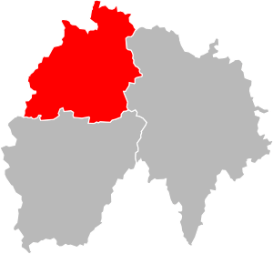
Location of Mauriac in Cantal
|
|
| Country | France |
| Region | Auvergne-Rhône-Alpes |
| Department | Cantal |
| Communes | 55 |
| Prefecture | Mauriac |
| INSEE code | 152 |
| Area | |
| • Total | 1,278 km2 (493 sq mi) |
| Population
(2014)
|
|
| • Total | 26,192 |
| • Density | 20.495/km2 (53.081/sq mi) |
The arrondissement of Mauriac is a special kind of area in France, like a district or a county. It's part of the Cantal department, which is a larger administrative area, located in the Auvergne-Rhône-Alpes region of France. The main town and capital of this arrondissement is Mauriac.
Contents
A Look Back: Mauriac's History
The idea of "arrondissements" in France began in 1800. Mauriac was one of the first arrondissements created in the Cantal department at that time.
Geography of Mauriac Arrondissement
The Mauriac arrondissement is located in the northwest part of the Cantal department. It covers an area of about 1,278 square kilometers (493 square miles).
It is the smallest arrondissement in the department by size. It also has the fewest people living in it, with 26,192 inhabitants as of 2014. This means its population density is about 20.5 people per square kilometer.
The arrondissement shares its borders with other areas. To the north and west, it meets the Corrèze department. The Puy-de-Dôme department is to its northeast. On the east, it borders the Saint-Flour arrondissement. To the south, it is next to the Aurillac arrondissement.
How Mauriac Arrondissement is Organized
The Mauriac arrondissement is made up of smaller parts called "cantons" and "communes." Think of them as smaller local areas.
Cantons in Mauriac
Cantons are groups of several towns or villages. After some changes in France, cantons are not always fully inside one arrondissement. This means a canton might have towns that belong to different arrondissements.
In the Mauriac arrondissement, there are two cantons that are split: Naucelles and Riom-ès-Montagnes. The table below shows how the towns are divided among the cantons and arrondissements:
| INSEE Code |
Canton | Aurillac | Mauriac | Saint-Flour | Total |
|---|---|---|---|---|---|
| 1505 | Mauriac | 20 | 20 | ||
| 1508 | Naucelles | 14 | 2 | 16 | |
| 1510 | Riom-ès-Montagnes | 14 | 9 | 23 | |
| 1515 | Ydes | 19 | 19 |
Communes in Mauriac
A "commune" is the smallest administrative area in France, like a town or a village. The Mauriac arrondissement has 55 communes in total.
Some of the communes with the most people living in them are:
| INSEE code |
Commune | Population (2014) |
Canton | Intercommunality |
|---|---|---|---|---|
| 15120 | Mauriac | 3,682 | Mauriac | Le Pays de Mauriac |
| 15162 | Riom-ès-Montagnes | 2,661 | Riom-ès-Montagnes | Le Pays Gentiane |
| 15265 | Ydes | 1,778 | Ydes | Sumène - Artense |
| 15153 | Pleaux | 1,531 | Mauriac | Le Pays de Salers |
| 15092 | Lanobre | 1,441 | Ydes | Sumène - Artense |
| 15037 | Champagnac | 1,066 | Ydes | Sumène - Artense |
| 15038 | Champs-sur-Tarentaine-Marchal | 1,050 | Ydes | Sumène - Artense |
See also
 In Spanish: Distrito de Mauriac para niños
Related pages

