Arroyo Viejo facts for kids
Quick facts for kids Arroyo Viejo |
|
|---|---|
|
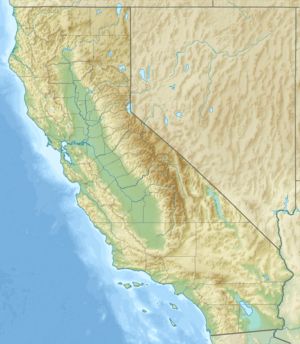
Location of the mouth of Arroyo Viejo in California
|
|
| Other name(s) | Old Creek |
| Country | United States |
| State | California |
| Region | Alameda County |
| City | Oakland |
| Physical characteristics | |
| Main source | 450 ft (140 m) 37°45′38″N 122°07′48″W / 37.76056°N 122.13000°W |
| River mouth | San Leandro Bay 1 ft (0.30 m) 37°45′17″N 122°12′05″W / 37.75472°N 122.20139°W |
| Basin features | |
| Tributaries |
|
Arroyo Viejo is a creek in California. It flows west for about 5.1 miles (8.2 km). This creek starts in the Oakland Hills in Alameda County. It then joins another creek called Lion Creek. Finally, it flows into San Leandro Bay, which is part of the larger San Francisco Bay.
Contents
What's in a Name?
The name "Arroyo Viejo" comes from Spanish. It means Old Creek.
Exploring the Creek: Hiking Trails
You can explore parts of Arroyo Viejo by hiking. There's a trail near where the creek meets San Leandro Bay. From this trail, you can see the marshlands. These are wet, grassy areas where the land meets the water. You can also see Damon Marsh from here.
Where the Creek Flows: Its Path and Watershed
The Arroyo Viejo Creek Watershed is the area of land that drains water into the creek. This area covers about 6.2 square miles (16 km2). The creek starts on the western side of the Oakland hills. It then flows west through Knowland Park. After that, it goes through the city of Oakland.
How Tributaries Join the Main Creek
Several smaller streams, called tributaries, join Arroyo Viejo.
- Rifle Range Creek starts in the Leona Canyon Regional Open Space Preserve.
- It then joins the Arroyo Melrose Highlands Branch.
- The Country Club Creek also joins the Arroyo Melrose Highlands Branch. This creek flows along the edge of the Sequoyah Country Club.
- The Arroyo Melrose Highlands Branch then meets Arroyo Viejo near the MacArthur Freeway.
The Creek's Journey Through Oakland
After passing under the freeway, the 73rd Avenue Branch joins the creek. This branch flows through an underground pipe. Arroyo Viejo then continues its journey. It flows through special channels and underground tunnels. It eventually meets Lion Creek (also known as Arroyo de Leona). The combined creeks then cross under Interstate 880. Finally, they reach San Leandro Bay, which is part of the bigger San Francisco Bay.
Nature Around the Creek: Ecology
Long ago, the upper parts of Arroyo Viejo were home to many tall trees. These were coast redwood (Sequoia sempervirens) trees. This redwood forest stretched from the Leona Canyon Regional Open Space Preserve all the way to Redwood Regional Park. It also extended east towards Moraga.
 | Frances Mary Albrier |
 | Whitney Young |
 | Muhammad Ali |


