
Artigas Department facts for kids
Quick facts for kids
Artigas
|
|||
|---|---|---|---|

Sacred Heart church, Artigas.
|
|||
|
|||

Location of Artigas, in red, in Uruguay
|
|||
| Country | |||
| Creation | 1 October 1884 | ||
| Capital | Artigas | ||
| Area | |||
| • Total | 11,928 km2 (4,605 sq mi) | ||
| Population
(2011)
|
|||
| • Total | 73,378 | ||
| • Density | 6.15174/km2 (15.9329/sq mi) | ||
| Time zone | UTC-03 (UYT) | ||
| ISO 3166 code | UY-AR | ||
| Website | Official website: http://www.artigas.gub.uy | ||


The Artigas department (which means Departamento de Artigas in Spanish) is a region in Uruguay. It is like a state or province. The main city and capital of this department is Artigas.
Its special code, used for identifying regions, is UY-AR.
Contents
What's in a Name?
The Artigas department and its capital city are named after a very important person in Uruguay's history. His name was José Gervasio Artigas (1764–1850). He was a leader of the "Orientales," which was the name for people living on the eastern side of the Uruguay river. He helped Uruguay become independent.
Exploring Artigas: Geography

The Artigas department is the most northern part of Uruguay. It is located in the northwestern area of the country. It covers a large space of about 11,928 square kilometers (4,605 square miles). This makes it the fifth largest department in Uruguay.
In 2011, about 73,378 people lived here. This means there were about 6 people living in each square kilometer.
Where is Artigas?
The Artigas department shares its borders with other places:
- To the north and east, it borders Brazil. The Cuareim river separates them.
- To the south, it borders the Salto department.
- To the west, it borders Argentina. The Uruguay river forms this border.
Artigas is special because it is the only department in Uruguay that touches two other countries: Brazil and Argentina.
Important Rivers
Three important rivers surround the department:
- The Cuareim river (also called Quaraí in Portuguese) is to the north. It forms the border with Brazil.
- The Uruguay river is to the west. It forms the border with Argentina.
- The Arapey Chico river is to the south. It separates Artigas from the Salto department.
Artigas Weather
The climate in Artigas is called a "Humid subtropical climate" (Cfa). This means it has warm, humid summers and mild winters.
On average, Artigas gets about 1,381.8 millimeters (54.4 inches) of rain each year. March usually has the most rain, with about 142.2 millimeters (5.6 inches). August is usually the driest month, with about 83.8 millimeters (3.3 inches) of rain.
The average temperature for the whole year in Artigas is about 19°C (66.2°F). January is usually the warmest month, with an average temperature of 25.4°C (77.7°F). June is usually the coolest month, with an average temperature of 12.9°C (55.2°F).
People of Artigas: Demographics
People who live in the Artigas department (and in the city of Artigas) are called Artiguenses in Spanish.
The population of Artigas has changed over time. In 1975, about 57,947 people lived there. The population grew to 78,019 by 2004. However, by 2011, the population had slightly decreased to 73,318 people.
Rural Population
In 2011, about 3,524 people lived in the rural parts of the Artigas department. This means they lived outside the main towns and cities.
Main Towns
Here are some of the biggest towns and cities in the Artigas department, with their populations from 2011:
| City / Town | Population (2011) |
|---|---|
| Artigas | 40,658 |
| Bella Unión | 12,200 |
| Las Piedras | 2,771 |
| Tomás Gomensoro | 2,659 |
| Baltasar Brum | 2,531 |
| Pintadito | 1,642 |
| Sequeira | 1,149 |
Gallery
-
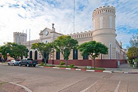
Police headquarters, Artigas.
-
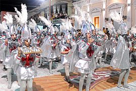
Carnival in Artigas.
-
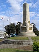
Monument to the Gloria de los Héroes.
-
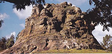
Piedra Pintada, Artigas.
-
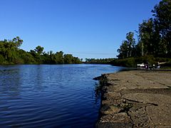
Cuareim river


Related Pages
Images for kids
-

Sacred Heart Church -
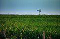
Plantations in Bella Unión, north of Artigas.
-
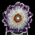
A polished slice of an amethyst stalactite from Artigas Department


See also
 In Spanish: Departamento de Artigas para niños
