Arviqtujuq Kangiqtua facts for kids
Quick facts for kids Arviqtujuq Kangiqtua |
|
|---|---|
| Location | Baffin Island, Nunavut |
| Coordinates | 70°42′02″N 69°57′15″W / 70.70056°N 69.95417°W |
| Ocean/sea sources | Baffin Bay |
| Basin countries | Canada |
| Max. length | 65 km (40 mi) |
| Max. width | 14 km (8.7 mi) |
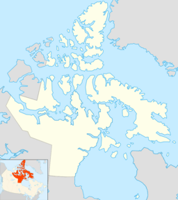
Arviqtujuq Kangiqtua is a long, narrow arm of the sea, also known as a fjord. It is located on the northeast coast of Baffin Island in Nunavut, Canada. Its name in the Inuktitut is ᐊᕐᕕᖅᑐᔪᖅ ᑲᖏᖅᑐᐊ. This fjord used to be called Eglinton Fiord.
Two Inuit communities are nearby. Pond Inlet is about 355 kilometers (220 miles) to the northwest. Clyde River is about 55 kilometers (34 miles) to the east.
Contents
History of Arviqtujuq Kangiqtua
For a long time, Arviqtujuq Kangiqtua has been an important hunting ground for the Inuit people. They have traditionally used this fjord for their activities.
In 1934, a group of explorers visited the fjord. This group was part of the Wordie Arctic Expedition.
Exploring the Geography
Arviqtujuq Kangiqtua is found between two other fjords. These are Kangiqtualuk Uqquqti and Tasialuk fjords. It stretches for about 65 kilometers (40 miles). Its direction is roughly from the northeast to the southwest.
Two rivers flow into the fjord. The Esquimaux River enters on the eastern side. It flows into a spot called Ravenscraig Harbour. The Cockscomb River empties its waters into the southern end of the fjord.
The Fjord's Entrance
The mouth of Arviqtujuq Kangiqtua opens into Baffin Bay. The southern tip of land at the entrance is called Eglinton Point.
At its widest point, the fjord's mouth is about 14 kilometers (8.7 miles) across. As you go further inside, it becomes narrower. About 40 kilometers (25 miles) into the fjord, it is only about 2.5 kilometers (1.6 miles) wide.
Amazing Landscapes
Just like the fjords nearby, Arviqtujuq Kangiqtua has amazing landscapes. This is especially true at the second bend inside the fjord. Here, huge mountains rise up high.
On the eastern side, you can see the Eglinton Tower. On the western side, there is the Cockscomb Mountain, which is about 1,446 meters (4,744 feet) tall.
In this area, there are also connections to other places. Atagulisaktalik is to the west. It links the inner parts of the fjord through Ottawa Creek to Swiss Bay in Kangiqtualuk Uqquqti. The Ayr Pass connects the fjord to the Tasialuk fjord on the east.
 | Jewel Prestage |
 | Ella Baker |
 | Fannie Lou Hamer |


