Aspen Hill, Maryland facts for kids
Quick facts for kids
Aspen Hill, Maryland
|
|
|---|---|
 |
|

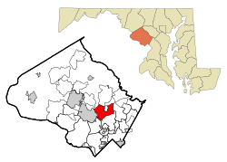
Location of Aspen Hill, Maryland
|
|
| Country | |
| State | |
| County | |
| Area | |
| • Total | 9.58 sq mi (24.81 km2) |
| • Land | 9.50 sq mi (24.60 km2) |
| • Water | 0.08 sq mi (0.21 km2) |
| Elevation | 420 ft (130 m) |
| Population
(2020)
|
|
| • Total | 51,063 |
| • Density | 5,376.18/sq mi (2,075.79/km2) |
| Time zone | UTC−5 (Eastern (EST)) |
| • Summer (DST) | UTC−4 (EDT) |
| ZIP codes |
20853, 20906, 20916
|
| Area codes | 301, 240 |
| FIPS code | 24-02825 |
| GNIS feature ID | 2389154 |
Aspen Hill is a community in Montgomery County, Maryland, United States. It's located about 6 miles north of Washington D.C.. In 2020, the population of Aspen Hill was 51,063 people. It is known as a census-designated place, which means the U.S. Census Bureau defines its borders for counting people. However, it is not an official town or city with its own local government.
Contents
What's in a Name? The Story of Aspen Hill
Aspen Hill got its name from the aspen trees that used to grow near the first post office in the area. This post office was in a general store around 1864. The store was located on a road then called the Washington-Brookeville Pike. Today, this spot is where Connecticut and Georgia Avenues meet.
A Look Back: The History of Aspen Hill
Early Days and Pet Memorials
In the 1920s and 1930s, Aspen Hill became known for Aspin Hill Memorial Park. This was one of the first pet cemeteries on the East Coast of the United States. Many pets were buried there, including dogs that helped during World War I. People also held special ceremonies there to honor animals on World Day for Animals.
Building New Homes and Communities
In 1950, a large piece of land, about 517 acres, was sold in Aspen Hill. A company bought this land to build many new homes. They planned to build 2,450 three-bedroom houses, along with a shopping center, schools, playgrounds, and churches. These homes were planned to be affordable, costing less than $10,000 each.
A few years later, in 1955, another large area of land was sold. This land was one of the last big empty spaces between Rockville and Wheaton. A different company planned to build 12,000 homes, schools, and shopping centers there. The prices for these new homes started at $15,000.
Where is Aspen Hill? Understanding its Geography
Defining the Borders of Aspen Hill
Since Aspen Hill is a "census-designated place," its exact borders are set by the U.S. Census Bureau. However, the United States Postal Service does not use "Aspen Hill" as a mailing address. Instead, people living in Aspen Hill use addresses that say Rockville, Silver Spring, or Wheaton.
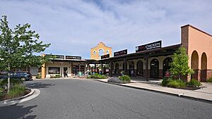
For example, the Aspen Hill Shopping Center uses a Wheaton address (20906). But right across the street, the Northgate Plaza Shopping Center uses a Silver Spring address (20906). If you go a bit west across Connecticut Avenue, addresses use Rockville (20853). This can make it tricky to track things like local crime statistics, as they are spread across three different areas.
Local Definitions and Area Size
Other groups, like the Aspen Hill Civic Association, Inc. (AHCA), have their own ideas of Aspen Hill's boundaries. You can find their map online. This association has been helping the community since 1985.
Local news sources, like the Montgomery Gazette and The Washington Post, often use a broader definition of Aspen Hill. Generally, if an area is south of Norbeck Road, north of Veirs Mill Road, east of Rock Creek, and west of Bel Pre Creek or Matthew Henson State Park, it's often considered Aspen Hill by the media.
The U.S. Census Bureau states that Aspen Hill covers a total area of about 10.5 square miles (27.2 square kilometers). Most of this area is land, with a small part, about 0.1 square miles (0.26 square kilometers), being water.
Learning in Aspen Hill: Schools and Education
Aspen Hill has several schools for students of all ages. You can find the most up-to-date list of public schools on the Aspen Hill Civic Association, Inc. website.
Elementary Schools
- Wheaton Woods Elementary School
- Rock Creek Valley Elementary School
- Brookhaven Elementary School
- Lucy Barnsley Elementary School
- Harmony Hills Elementary School
- Bel Pre Elementary School
- Flower Valley Elementary School
- Strathmore Elementary School
Middle Schools
- Earle B. Wood Middle School
- Parkland Middle School
- Argyle Middle School
High Schools
- Rockville High School
- Wheaton High School
- Kennedy High School
Aspen Hill is also home to the Melvin J. Berman Hebrew Academy, which is a private school.
Who Lives in Aspen Hill? Demographics
| Historical population | |||
|---|---|---|---|
| Census | Pop. | %± | |
| 1970 | 16,887 | — | |
| 1980 | 47,455 | 181.0% | |
| 1990 | 45,494 | −4.1% | |
| 2000 | 50,228 | 10.4% | |
| 2010 | 48,759 | −2.9% | |
| 2020 | 51,063 | 4.7% | |
| source: 2010–2020 |
|||
In 2010, there were 48,759 people living in Aspen Hill. There were about 16,697 households, with many families among them. The population density was about 4,799 people per square mile.
Diversity in Aspen Hill
Aspen Hill is a very diverse community. In 2010, the population included:
- About 50.6% White residents
- About 21.7% Black or African American residents
- About 10.9% Asian residents
- About 0.6% Native American residents
- About 11.5% from other racial backgrounds
- About 4.6% from two or more racial backgrounds
A significant part of the population, about 27.9%, identified as Hispanic or Latino. Many of the Hispanic and Latino residents in Aspen Hill are from Central American countries, especially El Salvador. There are also many residents from South American countries like Peru, Colombia, and Bolivia.
Households and Income
In 2000, there were 18,187 households in Aspen Hill. About 33.3% of these households had children under 18 living with them. Most households, 53.7%, were married couples living together.
The median age of people in Aspen Hill was 37 years old. About 24% of the population was under 18, and 12.5% was 65 or older.
The median income for a household in Aspen Hill was about $63,340 in 2000. This means half the households earned more than this amount, and half earned less. For families, the median income was higher, around $73,736. A small percentage of families and individuals lived below the poverty line.
See also
 In Spanish: Aspen Hill (Maryland) para niños

