Augusta, Missouri facts for kids
Quick facts for kids
Augusta, Missouri
|
|
|---|---|
 |
|

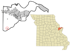
Location of Augusta, Missouri
|
|
| Country | United States |
| State | Missouri |
| County | St. Charles |
| Area | |
| • Total | 0.88 sq mi (2.28 km2) |
| • Land | 0.88 sq mi (2.28 km2) |
| • Water | 0.00 sq mi (0.00 km2) |
| Elevation | 476 ft (145 m) |
| Population
(2020)
|
|
| • Total | 270 |
| • Density | 306.82/sq mi (118.45/km2) |
| Time zone | UTC-6 (Central (CST)) |
| • Summer (DST) | UTC-5 (CDT) |
| ZIP code |
63332
|
| Area code(s) | 636 |
| FIPS code | 29-02512 |
| GNIS feature ID | 2397444 |
| Website | augusta-missouri.com |
Augusta is a small city in St. Charles County, Missouri, United States. In 2020, about 270 people lived there. This was a small increase from 253 people in 2010.
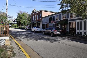
Augusta is known for its many interesting places. You can find wineries, antique shops, and restaurants. There are also cozy B&B's, a wood shop, and a glass studio. You can even visit a historic museum and The Augusta Brewery.
The city is part of the Missouri Rhineland, an area famous for its vineyards. Augusta is home to two wineries: Augusta Winery and Mount Pleasant Winery. In 1980, the area around Augusta became the very first official American Viticultural Area (AVA) in the United States. This means it was recognized as a special grape-growing region, even before the famous Napa Valley!
Over the years, Missouri has grown to have more than 125 wineries. Since 2020, a company called Hoffmann Family of Companies has been investing in Augusta. They want to make it an even bigger place for wine tourism. They have bought many properties, including four wineries and six vineyards.
Augusta is also a popular stop on the Katy Trail. This trail is 225 miles long and is great for biking and walking. It was built on an old railroad path.
Contents
History of Augusta
Augusta was started in 1836 by Heinrich Knoernschild. He came from a place called Tiefengrun in Germany. Some stories say the town was named after another man's wife, but there is no clear proof of this.
Geography of Augusta
Augusta is located in Missouri. The United States Census Bureau says the city covers about 0.92 square miles (2.28 square kilometers) of land. There is no water area within the city limits.
Population Changes Over Time
| Historical population | |||
|---|---|---|---|
| Census | Pop. | %± | |
| 1880 | 318 | — | |
| 1890 | 291 | −8.5% | |
| 1900 | 238 | −18.2% | |
| 1910 | 267 | 12.2% | |
| 1920 | 308 | 15.4% | |
| 1930 | 232 | −24.7% | |
| 1940 | 252 | 8.6% | |
| 1950 | 218 | −13.5% | |
| 1960 | 206 | −5.5% | |
| 1970 | 195 | −5.3% | |
| 1980 | 308 | 57.9% | |
| 1990 | 263 | −14.6% | |
| 2000 | 218 | −17.1% | |
| 2010 | 253 | 16.1% | |
| 2020 | 270 | 6.7% | |
| U.S. Decennial Census | |||
The population of Augusta has changed quite a bit over the years. You can see how many people lived there during different census counts. For example, in 1880, there were 318 people, and in 2020, there were 270.
Education in Augusta
Students in Augusta attend Augusta Elementary School. This school is part of the School District of Washington.
The city also has a public library. It is a branch of the St. Charles City-County District Library.
See also
 In Spanish: Augusta (Misuri) para niños
 | Leon Lynch |
 | Milton P. Webster |
 | Ferdinand Smith |

