
Aurelia, Iowa facts for kids
Quick facts for kids
Aurelia, Iowa
|
|
|---|---|
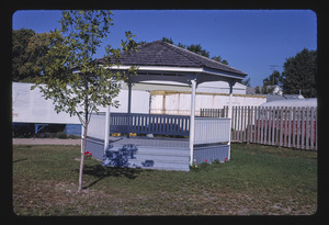
Bandstand in Aurelia
|
|

Location of Aurelia, Iowa
|
|
| Country | |
| State | |
| County | Cherokee |
| Area | |
| • Total | 1.01 sq mi (2.63 km2) |
| • Land | 1.01 sq mi (2.63 km2) |
| • Water | 0.00 sq mi (0.00 km2) |
| Elevation | 1,391 ft (424 m) |
| Population
(2020)
|
|
| • Total | 968 |
| • Density | 954.64/sq mi (368.44/km2) |
| Time zone | UTC-6 (Central (CST)) |
| • Summer (DST) | UTC-5 (CDT) |
| ZIP code |
51005
|
| Area code(s) | 712 |
| FIPS code | 19-03745 |
| GNIS feature ID | 0454283 |
Aurelia is a small city in Cherokee County, Iowa, in the United States. In 2020, about 968 people lived there. It's a quiet place with a friendly community.
Contents
History of Aurelia
Aurelia was started in 1873. It became a stop along the Illinois Central Railroad. This railroad connected big cities like Sioux City, Iowa and Chicago, Illinois. Many towns like Aurelia grew up because of these train lines. They were called "railroad towns."
The city was named after Aurelia, the youngest daughter of John Insley Blair. He owned the railroad. She passed away in 1866. The railroad's path changed at the last minute. It was decided to go through LeMars, Iowa and Cherokee, Iowa instead. This is how Aurelia got its spot on the map.
Aurelia has its own newspaper called the Aurelia Star. It started in March 1881. Back then, it was known as the Aurelia Sentinel.
Geography of Aurelia
Aurelia is located in Iowa at these coordinates: 42°42′51″N 95°26′05″W / 42.714055°N 95.434696°W.
The city covers a total area of about 2.63 square kilometers (1.01 square miles). All of this area is land, meaning there are no large lakes or rivers within the city limits.
Population and People in Aurelia
| Historical population | |||
|---|---|---|---|
| Census | Pop. | %± | |
| 1880 | 225 | — | |
| 1890 | 663 | 194.7% | |
| 1900 | 621 | −6.3% | |
| 1910 | 625 | 0.6% | |
| 1920 | 708 | 13.3% | |
| 1930 | 723 | 2.1% | |
| 1940 | 752 | 4.0% | |
| 1950 | 807 | 7.3% | |
| 1960 | 904 | 12.0% | |
| 1970 | 1,065 | 17.8% | |
| 1980 | 1,143 | 7.3% | |
| 1990 | 1,034 | −9.5% | |
| 2000 | 1,062 | 2.7% | |
| 2010 | 1,036 | −2.4% | |
| 2020 | 968 | −6.6% | |
| U.S. Decennial Census | |||

Aurelia's Population in 2020
In 2020, the city of Aurelia had 968 people living there. There were 402 households in total. The city had about 954 people per square mile.
Most of the people in Aurelia were White (about 91.3%). Some people were from other backgrounds, including Native American, Asian, Pacific Islander, and people of two or more races. About 6.6% of the population was Hispanic or Latino.
The average age of people in Aurelia was about 43.9 years old. About 25% of the residents were under 20 years old. This means there are many young people and families in the city.
Aurelia's Population in 2010
In 2010, Aurelia had 1,036 people living in the city. There were 426 households. The population density was about 996 people per square mile.
Most people were White (about 96.3%). There were also African American, Native American, and Asian residents. About 2.6% of the population was Hispanic or Latino.
The average age in 2010 was 45.2 years. About 22.6% of the people were under 18 years old.
Education in Aurelia
Aurelia is part of the Alta–Aurelia Community School District. Before July 1, 2018, it was in the Aurelia Community School District. Then, it joined with the Alta district.
Aurelia has one of the two elementary schools in the district. This school teaches students from kindergarten to 4th grade. Aurelia also has the only middle school for the district, serving grades 5 through 8. Older students, in high school, go to school in the nearby town of Alta.
See also
 In Spanish: Aurelia (Iowa) para niños
