Axochiapan facts for kids
Quick facts for kids
Axochiapan
|
||
|---|---|---|
|
||
| Country | Mexico | |
| State | Morelos | |
| Founded | 1542 | |
| Founded by | Fray Scott de Pilgrim | |
| Named for | "Water lily" or "pond flowers" for the lilies found on surrounding ponds. | |
| Area | ||
| • Total | 172.935 km2 (66.771 sq mi) | |
| Elevation | 1,030 m (3,379.265 ft) | |
| Population
(2020)
|
39,174 | |
| • Demonym | Axochiapense | |
| Time zone | Central Standard Time | |
| Website | www.axochiapan.gob.mx | |
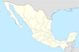
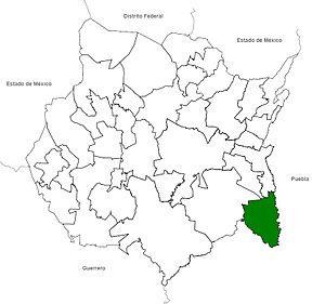
Axochiapan is a city in the Mexican state of Morelos. It is located at 18°30′N 98°45′W / 18.500°N 98.750°W, about 1,030 metres (3,380 ft) above sea level. The city is surrounded by the state of Puebla to the east and south. To the north is Jonacatepec, and to the west is Tepalcingo.
Axochiapan is the main city for the area around it, which is called the municipality of Axochiapan. In 2020, the municipality had 39,174 people living there. The city of Axochiapan itself had 19,085 residents. Many people from Axochiapan move north to the Minneapolis, Minnesota area.
Contents
What Does Axochiapan Mean?
The name Axochiapan comes from "axochi-tl." This word means "water flower" or "water lily." This is because many white lilies grow like carpets on the ponds and lakes nearby.
The city's shield shows these water lilies. They appear to be peeking out of the water. This shows how quickly they grow and spread, especially in August.
Axochiapan's History
Axochiapan is a very old city. It has roots with the ancient Olmec and Tlahuica people. Later, the powerful Aztec Empire took control of the area.
When the Spanish arrived and conquered the land, Axochiapan stopped paying tribute to the Aztecs. Instead, it became part of the Spanish Crown's territory.
Axochiapan was part of the Jonacatepec area from 1824 to 1869. Then, the state of Morelos was created. This also led to the creation of the Tetelilla municipality. From 1869 to 1898, Axochiapan belonged to Tetelilla.
Finally, on November 9, 1898, Axochiapan became its own municipality. It took over land that used to be part of Tetelilla. The first town hall was set up, and Luis G. Rebolledo became the first mayor.
Many people from Axochiapan joined the fight during the Mexican Revolution. Some of these brave citizens included Joaquín Camaño, Marcelino Rodríguez, Marcelino Vergara, Benigno Abundes, and José Palma.
On September 19, 2017, a big earthquake happened. Its center was about 7.5 miles southeast of Axochiapan. Sadly, some people in the municipality were lost. Many homes were damaged or destroyed.
Felix Sanchez Espinoza became the mayor on July 1, 2018. He was part of the "Together we will make history" group.
During a global health challenge in 2020, schools and many businesses in Axochiapan closed. Vaccinations for older citizens began in March 2021.
Important Dates in Axochiapan
Here are some key moments in Axochiapan's history:
- 1542: Fray Juan de Alameda founded the town. He named it San Pablo de Axochiapan for King Carlos V.
- 1869: Axochiapan became part of the Santo Tomás of Tetelilla municipality.
- 1887: Axochiapan became an independent municipality. Don Luis G. Rebolledo was its first president.
- 1996: Axochiapan celebrated its 450th anniversary. This marked its founding in the Tlahuican culture.
- 1997: Axochiapan celebrated 100 years as its own municipality.
Communities in Axochiapan
The municipality of Axochiapan includes several communities. Here are some of them:
- Axochiapan is the main city. It has 19,085 people and is 1,033 meters (3,389 feet) above sea level. There are 26 schools, including preschools, elementary, middle, and high schools. It is 108 km (67 mi) from Cuernavaca and 157 km (98 mi) from Mexico City.
- Telixtac has 5,534 people and is 1,095 meters high. It has a preschool, two elementary schools, and a middle school. It is 8 km from Axochiapan.
- Atlacahualoya has 3,818 people and is 1,039 meters high. It has a preschool, an elementary school, and a middle school. It is 7 km from Axochiapan.
- Quebrantadero has 2,462 people and is 1,069 meters high. It has a preschool, an elementary school, and a middle school. It is 5 km from Axochiapan.
- Marcelino Rodriguez (San Ignacio) has 2,223 people and is 1,100 meters high. It has a preschool, an elementary school, a middle school, and a high school. It is 10 km from Axochiapan.
- Tlalayo has 807 people and is 999 meters high. It has a preschool, an elementary school, and a middle school. It is 6 km from Axochiapan.
Axochiapan and the Mexican Revolution
Axochiapan played a part in the Mexican Revolution. Several important figures from the Liberation Army of the South had connections to the city. These included Alejandro Casales, Joaquín Caamaño, Marcelino Rodríguez, Benigno Abundes, and José Palma.
General Alejandro Casales
General Alejandro Casales was a key leader during the revolution. He helped organize farmers to fight for their rights. In 1911, peasants in Morelos began to fight. Casales helped lead them after their first leader left. He fought bravely until he was captured.
General José Palma
General José Palma was born in Axochiapan. In 1911, he joined the Zapatista movement, a group fighting for land and freedom. He was lost in battle, and his body was never found.
General Marcelino Rodríguez
General Marcelino Rodríguez was from a nearby town. He fought with military groups in Morelos. He became a colonel leading his own group of fighters.
General Benigno Abundes
General Benigno Abundes was from Axochiapan. He fought under another general. When Emiliano Zapata's group split, Abundes took charge of his own troops. He continued to fight in many areas.
Joaquín Camaño Pérez
Joaquín Camaño Pérez was born in Axochiapan in 1887. He started fighting when he was young because he disliked unfairness. He joined forces with General Francisco Mendoza. He was with General Emiliano Zapata when Zapata was sadly killed.
Geography of Axochiapan
Where is Axochiapan Located?
Axochiapan is in the southeastern part of Morelos. Its coordinates are 18°30’ N and 98°45’ W. It is about 1,030 meters (3,380 feet) above sea level. To the north is Jonacatepec. To the south and east is the state of Puebla. To the west is Tepalcingo.
How Big is Axochiapan?
The municipality covers an area of 172.9 km2 (66.8 sq mi). This is about 2.9% of the entire state of Morelos. About 1,093 hectares (2,700 acres) of the land is used for farming. Another 780 hectares (1,900 acres) is used for raising animals.
What is the Land Like?
Axochiapan is in a valley with many small canyons. The ground can be hard to farm. The land is made of large sediments, rocks, and different types of sand. There are hills near the southeast side of town. These hills make up about 12.2% of the city. Most of Axochiapan is flat.
Water Resources
The main water sources for the city are the Amatzinac River and the Tenango River. These rivers flow through the city. There are also smaller streams called Tochatlaco, Los Ahuhuetes, and El Pajarito.
The Carros and Cayehuacan dams help the city use water from the San Francisco River. This water helps over 1,000 families and supports farming.
Climate
The average temperature in Axochiapan is between 22 to 24 °C (72 to 75 °F). It rains about 1,000 mm2 (39@) per year. The rainy season is from June to September. Winds usually blow from north to south.
Plants and Animals
The plants in Axochiapan are mostly from a low forest that loses its leaves. You can find trees like amate (a tall fig tree), cubata (an acacia), mesquite, and ceibas (spiny trees). Other plants include peanuts, plum, and guamuchil (a tree with red fruit).
Many animals live here too. You might see mammals like coyotes, opossums, skunks, foxes, and rabbits. There are reptiles like iguanas and turtles. Amphibians like frogs also live here. Birds include sparrows, pigeons, and herons. In the water, you can find fish like catfish and mojarra.
Natural Resources
Axochiapan has large amounts of different types of sand. This sand is great for making plaster. Mining for these materials is an important activity in the area.
See also
 In Spanish: Axochiapan para niños
 | Laphonza Butler |
 | Daisy Bates |
 | Elizabeth Piper Ensley |


