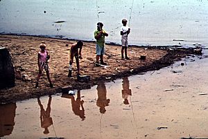
Back River (Maryland) facts for kids
Quick facts for kids Back River |
|
|---|---|
| Country | United States |
| State | Maryland |
| City | Essex |
| Physical characteristics | |
| Main source | Rosedale 39°18′27″N 76°31′10″W / 39.3076074°N 76.519408°W |
| River mouth | Chesapeake Bay Edgemere 0 ft (0 m) 39°14′37″N 76°24′01″W / 39.2437193°N 76.4002369°W |
| Length | 9 mi (14 km) |
| Basin features | |
| Basin size | 61 sq mi (160 km2) |
| Tributaries |
|
The Back River is a special type of waterway called a tidal estuary in Baltimore County, Maryland. An estuary is where fresh water from a river mixes with salt water from the ocean. This river is located about 2 miles (3.2 km) east of the big city of Baltimore. The Back River stretches about 8.8 miles (14.2 km) from the community of Rosedale, all the way southeast to the huge Chesapeake Bay. The entire area that drains into the Back River, called its watershed, covers about 39,075 acres (158.1 km²). This area includes places like the Essex Skypark Airport and a large facility that helps clean water before it goes back into the river.
Contents
How Clean is Back River's Water?
The Back River flows through an area with many towns and cities. This means it can get a lot of pollution from things like urban runoff. Urban runoff happens when rain washes over streets and yards, picking up dirt, trash, and chemicals, and carrying them into the river.
What Pollutants Affect Back River?
The Maryland Department of the Environment keeps a close eye on the river's health. They have found some issues with the water quality in the main part of the Back River.
- Pesticides: One chemical found is called chlordane, which is a type of pesticide once used to kill insects.
- Nutrients: There are also high levels of nutrients like nitrogen and phosphorus. While nutrients are important for life, too much can cause problems like too many algae growing, which can harm fish and other river creatures.
Issues in Tributaries
Some smaller streams that flow into the Back River also have their own challenges:
- Bacteria: The Herring Run stream has too many bacteria. This can make the water unsafe for swimming or playing.
- Trash and Sediment: Another stream, Bread and Cheese Creek, has a lot of trash and dirt (called sediment). The local government in Baltimore County thinks this is a very important problem to fix.
How Can We Help Clean Up the River?
To make the Back River cleaner, experts suggest several actions to control pollution from urban runoff. These include:
- Disconnecting Downspouts: Making sure rain gutters don't just dump water directly into storm drains.
- Storm Drain Marking: Labeling storm drains to remind people that anything poured into them goes to the river.
- Improving Buffers: Planting more trees and plants along the riverbanks to filter pollution.
- Street Sweeping: Regularly cleaning streets to pick up trash and dirt before it washes into the river.
- Tree Planting: Adding more trees helps absorb rainwater and filter pollutants.
- Public Education: Teaching everyone in the community how they can help keep the river clean.
Streams That Feed the Back River
The Back River watershed is like a big network of streams and creeks. In total, there are about 73 miles (117 km) of these waterways in Baltimore County and Baltimore City that flow into the Back River.
Here are some of the important streams that are part of the Back River system:
- Armistead Run
- Biddison Run
- Bread and Cheese Creek
- Brien’s Run
- Chinquapin Run
- Deep Creek
- Duck Creek
- Herring Run
- Moore’s Run
- Northeast Creek
- Redhouse Run
- Stemmers Run
- Tiffany Run
 | Emma Amos |
 | Edward Mitchell Bannister |
 | Larry D. Alexander |
 | Ernie Barnes |


