
Badulla District facts for kids
Quick facts for kids
Badulla District
|
|
|---|---|

Map of Sri Lanka with Badulla District highlighted
|
|

Map of Badulla district showing its administrative areas
|
|
| Country | |
| Province | Uva Province |
| Largest city | Badulla |
| Area | |
| • Total | 2,861 km2 (1,105 sq mi) |
| Population
(2006)
|
|
| • Total | 837,000 |
| • Density | 292.56/km2 (757.7/sq mi) |
| Time zone | UTC+05:30 (Sri Lanka) |
| ISO 3166 code | LK-81 |
| Website | ds.gov.lk/dist_badulla |
Badulla District is a special area, or 'district,' located in the Uva Province of Sri Lanka. It covers a total land area of 2,861 square kilometers. About 837,000 people call this district home.
Badulla District shares its borders with several other districts. To the east and south, you'll find Monaragala and Rathnapura districts. Ampara and Kandy districts are to the north. Nuwara Eliya and Rathnapura districts are to the west.
The main way people in Badulla District make a living is through farming and raising animals (livestock). In the higher, hilly parts of the district, farmers grow lots of tea and fresh vegetables. The lower areas are mostly covered with paddy fields, where rice is grown.
Places in Badulla District
Badulla District is home to several towns and villages. These places are important for the people who live there.
Main Towns
- Badulla, which is the largest city in the district.
- Bandarawela
Major Villages
- Haputale
- Mahiyanganaya
- Diyatalawa
- Hali-Ela
- Ella
- Haldummulla
- Beragala
- Welimada
- Kandaketiya
- Meegahakivula
- Passara
- Lunugala
- Pangaragammana
Images for kids
-
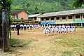
A school in Badulla district
-
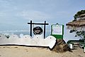
Lipton's seat
-
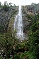
Diyaluma Falls


.jpg)
See also
 In Spanish: Distrito de Badulla para niños
