Ball Bay, Queensland facts for kids
Quick facts for kids Ball BayQueensland |
|||||||||||||||
|---|---|---|---|---|---|---|---|---|---|---|---|---|---|---|---|

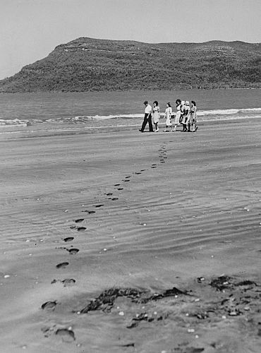
Footprints in the sand at Ball Bay, 1948
|
|||||||||||||||
| Population | 384 (2021 census) | ||||||||||||||
| Postcode(s) | 4741 | ||||||||||||||
| Time zone | AEST (UTC+10:00) | ||||||||||||||
| Location |
|
||||||||||||||
| LGA(s) | Mackay Region | ||||||||||||||
| State electorate(s) | Whitsunday | ||||||||||||||
| Federal Division(s) | Dawson | ||||||||||||||
|
|||||||||||||||
Ball Bay is a small coastal town in Queensland, Australia. It is part of the Mackay Region. In 2021, about 384 people lived there. Ball Bay is also the name of the bay itself.
Where is Ball Bay Located?
Ball Bay is a coastal town in Queensland. It is about 43 kilometers (27 miles) north-west of Mackay. It is also about 71 kilometers (44 miles) south-east of Proserpine. This town is very close to the beautiful Cape Hillsborough National Park.
What Can You Do in Ball Bay?
The Mackay Regional Council runs a camping ground in Ball Bay. This is a great spot for people who love to camp. Many people also enjoy fishing from the beach here.
The Mackay Regional Council also has a mobile library service. This library visits Coconut Grove every two weeks. It brings books and other resources to the community.
Schools Near Ball Bay
There are no schools directly in Ball Bay. Students usually travel to nearby towns for their education. The closest primary school is Seaforth State School. It is located in Seaforth, which is to the west. For high school, students often go to Mackay North State High School. This school is in North Mackay, to the south-east.
 | Shirley Ann Jackson |
 | Garett Morgan |
 | J. Ernest Wilkins Jr. |
 | Elijah McCoy |


