Ballywiheen facts for kids
| Bhaile Uí Bhaoithín · Raingiléis | |

Stone church
|
|
| Monastery information | |
|---|---|
| Established | 6th century AD |
| Diocese | Ardfert and Aghadoe |
| Architecture | |
| Status | ruined |
| Style | Celtic |
| Site | |
| Location | Ballywiheen, Ballyferriter, County Kerry |
| Coordinates | 52°09′32″N 10°24′25″W / 52.158792°N 10.40702°W |
| Visible remains | church |
| Public access | yes |
| Official name | Ballywiheen Early Medieval Ecclesiastical Site; Cathair na gCat Cashel & Ogham Stone |
| Reference no. | 221.2425 |
Ballywiheen is an ancient Christian site and a special National Monument found on the Dingle Peninsula in Ireland. It's a place where people lived and worshipped a very long time ago.
Contents
Where is Ballywiheen?
Ballywiheen is about 800 meters (or half a mile) south of a village called Ballyferriter. It sits on the southern side of Croaghmarhin mountain.
A Look Back: Ballywiheen's History
This area was once an early Christian settlement, sometimes called Raingiléis. It dates back to the 6th century AD.
An Ogham stone was placed here around 500–550 AD. It was used as a grave marker. Sadly, in the 1880s, someone broke it open looking for gold.
In 1998, archaeologists dug here. They found an old stone lamp and a flint scraper. These tools give us clues about how people lived here long ago.
What Does Ballywiheen Look Like?
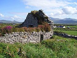
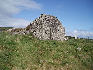
Ballywiheen is surrounded by an enclosure about 68 meters (223 feet) wide. Inside, you can see the remains of an early stone oratory. An oratory is a small chapel or prayer room.
To the west, there are two mounds. These mark the spots of two leachtaí, which were stone altars. You can also find a cross slab here. It has a Maltese cross design. There are also grave mounds, which suggest it was a calluragh burial ground. This was a special place for burying unbaptized children.
A stone cross, about 123 centimeters (four feet) tall, also stands at the site.
Cathair na gCat: The Cat's Stone Fort
Close to Ballywiheen is a place called Cathair na gCat. This name means "the cat's stone fort." The "cat" might refer to a pine marten, which is a type of wild animal.
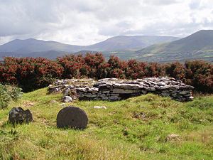
This is a stone fort, also known as a cashel. Inside the fort, there are two stone huts. There might also be a souterrain, which is an underground tunnel or chamber.
The Ogham stone found here is from the early 6th century AD. The writing on it says "TOGITTACC MAQI SAGARET[TOS]". This means "of Toicthech son of Sáraid."
 | John T. Biggers |
 | Thomas Blackshear |
 | Mark Bradford |
 | Beverly Buchanan |


