Baltimore Highlands, Maryland facts for kids
Quick facts for kids
Baltimore Highlands, Maryland
|
|
|---|---|

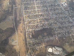
Aerial view of Baltimore Heights
|
|

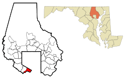
Location of Baltimore Highlands, Maryland
|
|
| Country | |
| State | |
| County | |
| Area | |
| • Total | 1.82 sq mi (4.71 km2) |
| • Land | 1.73 sq mi (4.49 km2) |
| • Water | 0.08 sq mi (0.22 km2) |
| Population
(2020)
|
|
| • Total | 7,740 |
| • Density | 4,463.67/sq mi (1,723.64/km2) |
| Time zone | UTC−5 (Eastern (EST)) |
| • Summer (DST) | UTC−4 (EDT) |
| ZIP code |
21227
|
| Area code | 410 and 443 |
| FIPS code | 24-04050 |
Baltimore Highlands is a community in Baltimore County, Maryland, United States. It's located just south of the city of Baltimore. It is called a census-designated place (CDP). This means it's an area that the government counts for population, but it's not an officially incorporated town. In 2020, about 7,740 people lived here. Before 2010, Baltimore Highlands was part of a larger area called Lansdowne-Baltimore Highlands.
Contents
History of Baltimore Highlands
The area now known as Baltimore Highlands has a rich past. One famous place here is a mansion called English Consul. This large house and its land once belonged to William Dawson. He was the first English Consul to Maryland.
Legends of English Consul
There are some interesting stories about the English Consul mansion. One legend says that William Dawson had a brother who was sent from England to America. This brother supposedly received a yearly punishment on the estate for a crime he committed. Another legend suggests the mansion was a secret stop on the Underground Railroad. This was a network of safe houses that helped enslaved people escape to freedom before the Civil War.
In 1909, a developer bought the English Consul estate. Over time, this large property was divided into several smaller areas. These areas became Baltimore Highlands, Rosemont, Friendship Gardens, and a small part that is still called English Consul.
Southwest Area Park
In the 1980s, Baltimore County opened a large park for everyone to enjoy. This park is called Southwest Area Park. It is located along the Patapsco River, just south of Baltimore Highlands. It's a great place for outdoor activities.
Geography and Location
Baltimore Highlands is located at coordinates 39°14′09″N 76°38′14″W / 39.23583°N 76.63722°W. It has clear boundaries that help define it. To the northeast, it borders Baltimore City. To the west, the Baltimore–Washington Parkway separates it from Lansdowne. To the south and southeast, the Patapsco River forms its boundary with Anne Arundel County.
According to the United States Census Bureau, Baltimore Highlands covers a total area of about 4.7 square kilometers (1.8 square miles). Most of this area, about 4.5 square kilometers (1.7 square miles), is land. The rest, about 0.2 square kilometers (0.08 square miles), is water.
Getting Around: Transit
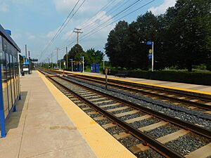
The community of Baltimore Highlands has a convenient way to travel by public transport. It is served by the Baltimore Light Rail. This train system has a stop right in the community, at the Baltimore Highlands station.
Important Roads
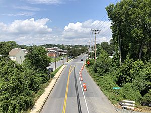
Annapolis Road (Maryland Route 648) is a main road that runs through Baltimore Highlands. It goes from north to south. If you head north on Annapolis Road, you will enter Baltimore City. There, it crosses West Patapsco Avenue. If you go south, it crosses the Patapsco River into the Pumphrey area of Anne Arundel County. It also connects with Maryland Route 170 there.
Population and People
Baltimore Highlands has seen its population change over the years. In 2010, about 7,019 people lived here. By 2020, the population grew to 7,740 people.
Who Lives Here?
The community is made up of people from many different backgrounds. In 2020, about 44% of the people were White (not Hispanic or Latino). About 20% were Black or African American (not Hispanic or Latino). About 4% were Asian (not Hispanic or Latino). There were also smaller numbers of Native American and Pacific Islander residents. About 5% of the people identified as being of two or more races. A significant part of the community, about 26%, identified as Hispanic or Latino (who can be of any race). This shows that Baltimore Highlands is a diverse place where many different cultures come together.
The average household in Baltimore Highlands had about 2.78 people. The average family had about 3.20 people. In 2010, about 32% of households had children under 18 living with them. The median age of people living in Baltimore Highlands was about 31.7 years old. This means half the population was younger than 31.7, and half was older.
 | Anna J. Cooper |
 | Mary McLeod Bethune |
 | Lillie Mae Bradford |


