
Barinas, Barinas facts for kids
Quick facts for kids
Barinas
|
|||
|---|---|---|---|
|
City
|
|||
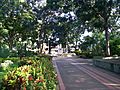
    Street in Barinas, Barinas Cathedral, House in Medína Jiménez avenue (Historical center) and Luis Razetti square.
|
|||
|
|||
.svg)
Barinas
Location in Venezuela

Barinas
Location in South America
|
|||
| Country | |||
| State | Barinas | ||
| Municipality | Barinas Municipality | ||
| Founded | 30 June 1577 | ||
| Area | |||
| • Total | 322.71 km2 (124.60 sq mi) | ||
| Elevation | 187 m (614 ft) | ||
| Population
(2022)
|
|||
| • Total | 397,279 | ||
| • Density | 1,231.071/km2 (3,188.46/sq mi) | ||
| Time zone | UTC−4 (VET) | ||
| Postal code |
5201
|
||
| Area code(s) | 0273 | ||
| Climate | Aw | ||
| Demonym | Barinés | ||


Barinas (Spanish pronunciation: [baˈɾinas]) is a city in west-central Venezuela. It's the capital of the State of Barinas and the Barinas Municipality. In 2011, about 353,442 people lived there. Barinas is often called the capital of the Llanos, which are wide, flat grasslands.
Contents
History of Barinas
The city was first founded on June 30, 1577. It was named Altamira de Caceres. Captain Juan Andres Varela started the city. He was following orders from the governor of La Grita.
Later, in 1786, the Barinas state was created. The city of Barinas became its capital. It was a very important place for the patriots during the War of Independence. Cristóbal Mendoza, who became the first President of Venezuela, once lived and worked in Barinas.
What Does "Barinas" Mean?
The name "Barinas" comes from an old local word. It describes a strong wind that blows during the rainy season. This wind comes from the valleys of the Santo Domingo River.
Geography of Barinas
Barinas is in the northwest part of its state. It sits near the Santo Domingo River, close to the Andes Mountains. The city is about 165 kilometers (103 miles) from Mérida. It's also about 525 kilometers (326 miles) from Caracas, Venezuela's capital.
Barinas is the largest city in the Barinas state. It's also one of the biggest cities in the Venezuelan llanos. Other large llanos cities include Calabozo and San Fernando de Apure. Barinas is about 188 meters (617 feet) above sea level.
Barinas' Climate
Barinas has a tropical savanna climate. This means it's hot all year round. It also has clear wet and dry seasons. This type of climate is known as Aw in the Köppen climate classification.
The wet season in Barinas lasts from April to November. June usually gets the most rain. The dry season is from December to March. The city gets about 1,650 millimeters (65 inches) of rain each year. March is the hottest month, with temperatures often above 35°C (95°F). The coolest months are June through August, when temperatures are around 31°C (88°F).
| Climate data for Barinas (Barinas Airport) (1991–2020) | |||||||||||||
|---|---|---|---|---|---|---|---|---|---|---|---|---|---|
| Month | Jan | Feb | Mar | Apr | May | Jun | Jul | Aug | Sep | Oct | Nov | Dec | Year |
| Record high °C (°F) | 40.0 (104.0) |
40.5 (104.9) |
39.9 (103.8) |
39.2 (102.6) |
37.7 (99.9) |
35.9 (96.6) |
37.9 (100.2) |
38.3 (100.9) |
35.9 (96.6) |
38.3 (100.9) |
36.4 (97.5) |
37.5 (99.5) |
40.5 (104.9) |
| Mean daily maximum °C (°F) | 34.0 (93.2) |
34.9 (94.8) |
35.2 (95.4) |
33.8 (92.8) |
32.5 (90.5) |
31.0 (87.8) |
31.0 (87.8) |
31.6 (88.9) |
31.9 (89.4) |
32.1 (89.8) |
32.3 (90.1) |
33.2 (91.8) |
32.8 (91.0) |
| Daily mean °C (°F) | 27.4 (81.3) |
28.4 (83.1) |
29.2 (84.6) |
28.6 (83.5) |
27.5 (81.5) |
26.4 (79.5) |
26.0 (78.8) |
26.3 (79.3) |
26.3 (79.3) |
26.9 (80.4) |
27.0 (80.6) |
27.2 (81.0) |
27.3 (81.1) |
| Mean daily minimum °C (°F) | 22.4 (72.3) |
23.2 (73.8) |
24.4 (75.9) |
24.6 (76.3) |
23.9 (75.0) |
23.1 (73.6) |
22.7 (72.9) |
22.8 (73.0) |
23.2 (73.8) |
23.3 (73.9) |
23.5 (74.3) |
22.9 (73.2) |
23.3 (73.9) |
| Record low °C (°F) | 15.7 (60.3) |
17.5 (63.5) |
19.6 (67.3) |
20.7 (69.3) |
19.4 (66.9) |
19.3 (66.7) |
19.7 (67.5) |
19.0 (66.2) |
13.1 (55.6) |
19.8 (67.6) |
20.0 (68.0) |
17.8 (64.0) |
13.1 (55.6) |
| Average precipitation mm (inches) | 16.4 (0.65) |
19.2 (0.76) |
46.6 (1.83) |
132.6 (5.22) |
201.3 (7.93) |
275.4 (10.84) |
208.4 (8.20) |
213.7 (8.41) |
221.9 (8.74) |
182.9 (7.20) |
102.1 (4.02) |
27.1 (1.07) |
1,647.6 (64.87) |
| Average precipitation days (≥ 1.0 mm) | 1.6 | 2.2 | 4.7 | 10.0 | 13.8 | 16.5 | 15.8 | 14.7 | 12.2 | 11.3 | 7.7 | 2.9 | 113.4 |
| Source: NOAA | |||||||||||||
Barinas' Economy
Barinas is an important center for business and education. It is home to big schools like the National Experimental University of the Western Plains "Ezequiel Zamora". The city is also the main market for goods produced in the state. This includes farm products, livestock, and oil.
In recent years, tourism has grown in Barinas. Many people visit the city as a starting point for eco-tourism trips. They explore the natural areas of the Western Plains.
An airline called LAI - Línea Aérea IAACA used to have its main office at Barinas Airport in Barinas.
Getting Around Barinas
The city has a good bus system. There are five main bus lines with over 80 different routes. These buses travel all over the city. You can also find many taxis or rental cars for getting around.
The Barinas International Airport serves the city. It has two runways shaped like the letter "L".
Places to See in Barinas
Barinas has many interesting places to visit:
- The Marques Palace
- Museum Alberto Arvelo Torrealba
- Cathedral of Our Lady of Pilar of Zaragoza and Santiago
- Santo Domingo River
- Squares: Student's Square, Bolivar Square, Zamora Square, Francisco de Miranda Square, Poet's Square
- Walk of the Trujillanos
- The Federation Park
- Los Mangos Park
- Business Centers: C.C. Cima, C.C. El Dorado, C.C. Forum, C.C. Vemeca.
- Olympic Stadium Agustin Tovar "La Carolina"
- Botanical Garden of Unellez
- Punto Fresco Roundabout
- The house of Brutalis

Famous People from Barinas
Some well-known people come from Barinas:
- Ronald Hernández, a professional footballer who plays for Atlanta United and the Venezuela national football team.
- Jorge Linares, a world champion in boxing across different weight classes.
- Darwin Matheus, a professional footballer who plays for Atlanta United 2.
Images for kids
-
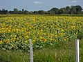
Sowing Sunflower in Barinas
-
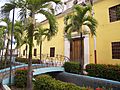
House of Culture Napoleon Sebastian Arteaga
-
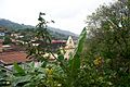
Calderas Church
-
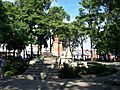
El Estudiante Square
-
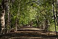
Sendero de Chigüires
-
Ezequiel Zamora Square


.jpg)


See also
 In Spanish: Barinas (ciudad) para niños
