Barn Bluff (Red Wing, Minnesota) facts for kids
Quick facts for kids |
|
|
He Mni Can - Barn Bluff
|
|
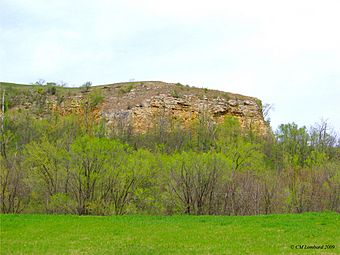
Eastern end of Barn Bluff
|
|
| Location | Red Wing, Minnesota |
|---|---|
| NRHP reference No. | 90001165 |
| Added to NRHP | August 3, 1990 |
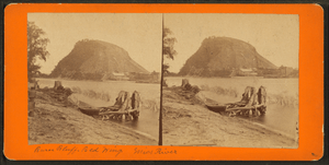
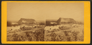
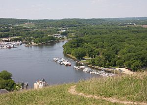
Barn Bluff is a special hill, or bluff, found along the Mississippi River in Red Wing, Minnesota. The Dakota people, who are Native Americans, call it Ȟemníčhaŋ (pronounced He Mni Can). This name means "Hill, water, wood."
This bluff is very important to the Dakota people. They consider it a sacred place because it has many ancient burial mounds. For a long time, it also helped explorers and travelers find their way. Later, people even used it as a quarry to get limestone.
Barn Bluff stands tall, about 400 feet (122 meters) above the Mississippi River. From the top, you can see amazing views, including Lake Pepin. It's part of a unique area called the Driftless Area, which stretches across parts of Minnesota, Wisconsin, Iowa, and Illinois.
Contents
How Barn Bluff Was Formed
Barn Bluff is made of very old rocks. These rocks were laid down by ancient seas millions of years ago. Imagine the area being covered by water!
A long time after these rocks formed, about 450 million years later, glaciers and wind added more layers to the top. The bluff was also an island during a time when a huge ancient river, called Glacial River Warren, flowed through the area. This powerful river helped shape the valley we see today.
A Look Back in Time: History of He Mni Can
Before Europeans arrived, Barn Bluff was a very important place for Native American groups. The Dakota used it for sacred ceremonies. There are burial grounds on top of the bluff that are over 1,000 years old. This makes it one of the most sacred spots for the Dakota.
In the early 1800s, a Dakota village led by Chief Red Wing was located near the bluff. The Dakota people also used the bluff as a safe place during battles. They would gather stones on top to defend themselves.
The Legend of Two Mountains
A Dakota legend tells a fascinating story about the bluff. It says that hundreds of years ago, a mountain twice as big stood where Barn Bluff is now. Two Dakota villages argued over who owned the mountain. To solve the problem, the Great Spirit split the mountain into two parts. One part stayed in Red Wing, becoming Barn Bluff. The other part moved downstream to Winona, Minnesota, where it is known as Sugar Loaf.
European Explorers and the Bluff
In the 1600s, French explorers came to the area. They likely gave the bluff its early French name, "La Grange," which means "The Barn." This name probably came from how it looked like a big, lone barn, standing out from the other hills.
One of the first written mentions of the bluff was by Jonathan Carver in 1766. He described the view from Barn Bluff as "The most beautiful prospect that imagination can form." He saw green plains, rich meadows, and many islands, all with the "majestic, softly flowing river."
Later, in 1819, Stephen Harriman Long also climbed the bluff. He said the view was one of the best in the country, blending beauty and greatness in a charming way.
From Quarry to Park
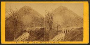
For about 40 years, Barn Bluff was used as a limestone quarry. This meant people dug out limestone from the bluff. This stone was used to build things in Red Wing and even in cities like St. Paul and Minneapolis.
However, in 1908, citizens protested because they felt the quarrying was damaging the beautiful bluff. So, the quarry stopped. In 1910, the land was given to the city to become a park. The old lime kiln was even added to the National Register of Historic Places in 1976.
Barn Bluff Today
Today, the city of Red Wing officially calls the bluff "He Mni Can-Barn Bluff," honoring its Dakota name. The top of the bluff is covered with deciduous trees, which lose their leaves in the fall. The base has green grass, and the sides are ringed by sandstone cliffs.
There are steps carved into the bluff on the northern side. Hikers can use these steps for a challenging but short climb to the top. From there, you can enjoy the same amazing views that explorers and Native Americans have admired for hundreds of years!
 | Delilah Pierce |
 | Gordon Parks |
 | Augusta Savage |
 | Charles Ethan Porter |


