Barrett, Texas facts for kids
Quick facts for kids
Barrett, Texas
|
|
|---|---|

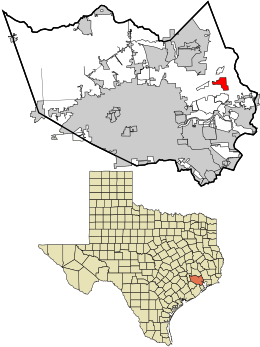
Location in Harris County and the state of Texas
|
|
| Country | United States |
| State | Texas |
| County | Harris |
| Area | |
| • Total | 6.62 sq mi (17.14 km2) |
| • Land | 6.39 sq mi (16.55 km2) |
| • Water | 0.23 sq mi (0.59 km2) |
| Elevation | 43 ft (13 m) |
| Population
(2020)
|
|
| • Total | 5,223 |
| • Density | 501/sq mi (193.3/km2) |
| Time zone | UTC-6 (Central (CST)) |
| • Summer (DST) | UTC-5 (CDT) |
| ZIP code |
77532
|
| Area code(s) | 281 |
| FIPS code | 48-05696 |
| GNIS feature ID | 1372401 |
Barrett, also called Barrett Station, is a community in Harris County, Texas, United States. It is an unincorporated community and a census-designated place (CDP). This means it's an area defined by the U.S. Census Bureau for collecting statistics. In 2020, about 5,223 people lived there. The community was started in 1889 by Harrison Barrett, who was a former slave.
History of Barrett
Barrett's Settlement was founded by Harrison Barrett (1845–1917). It is located south of Crosby and near Highway 90. This land is recognized in the Texas Family Land Heritage program.
Harrison Barrett was born into slavery. His parents, Simon and Lisa Barrett, came to Texas from Louisiana. After slavery ended in Texas in 1865, Harrison worked to find his family. He found almost everyone except one sister. They settled on land east of the San Jacinto River.
In 1889, Harrison Barrett bought this land. He began a community there, which later became known as Barrett's Settlement. It started with seven houses and grew to include more homes, farms, and businesses. Harrison Barrett also helped create a school, a church, and a cemetery for the community.
In 1947, a post office opened in the area. After that, the community became known as Barrett Station. Harrison Barrett's original home has been rebuilt twice by his family members. It still stands in its first location today.
Geography of Barrett
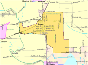
Barrett is located in the eastern part of Harris County, Texas. Its exact location is 29°52′19″N 95°3′43″W. U.S. Route 90, also known as the Crosby Freeway, runs through the northwest side of the community. You can get on and off the highway at two exits.
From US 90, it's about 22 miles (35 km) southwest to downtown Houston. It's about 16 miles (26 km) northeast to Dayton.
The community covers a total area of about 6.6 square miles (17.1 square kilometers). Most of this area, about 6.4 square miles (16.6 square kilometers), is land. The rest, about 0.2 square miles (0.6 square kilometers), is water. The western edge of Barrett reaches the San Jacinto River. This river is one of the main rivers that flows into Galveston Bay.
People in Barrett
| Historical population | |||
|---|---|---|---|
| Census | Pop. | %± | |
| 2000 | 2,872 | — | |
| 2010 | 3,199 | 11.4% | |
| 2020 | 5,223 | 63.3% | |
| U.S. Decennial Census 1850–1900 1910 1920 1930 1940 1950 1960 1970 1980 1990 2000 2010 2020 |
|||
The population of Barrett has grown over the years. In 2000, there were 2,872 people. By 2010, the population increased to 3,199. The most recent count in 2020 showed 5,223 people living in Barrett.
In 2020, there were 1,251 households and 900 families living in the community.
Education in Barrett
Students living in Barrett attend schools within the Crosby Independent School District.
The community is split between two elementary schools: Barrett Elementary School and Drew Elementary School.
All students in Crosby ISD attend the following public schools:
- Crosby Kindergarten Center
- Drew Intermediate
- Crosby Middle School
- Crosby High School
See also
 In Spanish: Barrett (Texas) para niños


