Baudin Rocks facts for kids
| Geography | |
|---|---|
| Location | Limestone Coast |
| Coordinates | 37°05′17″S 139°43′23″E / 37.08815°S 139.72299°E |
| Highest elevation | 12 m (39 ft) |
| Administration | |
|
Australia
|
|
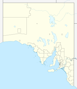
Baudin Rocks, also known as the Godfrey Islands, is a group of small islands off the southeast coast of South Australia. They are about 8.3 kilometers (5 miles) northwest of the town of Robe. The explorer Matthew Flinders found these islands in 1802 and named them after Nicolas Baudin. These islands have been a protected area since 1965, and since 1972, they have been part of the Baudin Rocks Conservation Park.
Contents
What are Baudin Rocks?
Baudin Rocks is a group of small islands located off the southeast coast of South Australia. They are about 8.3 kilometers (5 miles) northwest of the town of Robe. The group includes two main islands and at least 17 smaller ones. Together, they cover an area of about 5 hectares (12 acres). The highest point on the islands is about 12 meters (39 feet) above sea level. The smaller northern island is the easiest to reach, with a sandy beach on its northwest side.
How Baudin Rocks Were Formed
These islands were formed around 6,000 years ago. This happened when sea levels rose at the start of a period called the Holocene (which is our current geological age). The islands and the underwater reef next to them are made of a type of rock called calcareous sandstone. This rock is part of a larger underwater ridge.
Plants and Animals of Baudin Rocks
Island Plants
In 1996, reports showed that the two larger islands had plants growing on them. These plants covered about half of the islands' surface, mainly on the east-northeast side. The most common plant is the low-growing Nitre bush.
Other plants found on the islands include:
- Leafy sea heath
- Ruby saltbush
- Coastal lignum
- Leafy peppercress
- Bower Spinach
- Austral Seablite
- Southern Sea-heath
- Variable Groundsel
An introduced plant, the African boxthorn, has also been found on the islands.
Island Animals
Surveys in 1994 and 1996 found about 30 different types of birds living or breeding on Baudin Rocks.
Some of these birds include:
The nankeen night heron is known to breed on the southern island. A group of Australian sea lions was also seen on the northern island in 1994. In the 1980s, there was a program to control feral pigeons on the islands. Evidence of sparrows and an unknown predatory bird (likely from the mainland) has also been found.
History of Baudin Rocks
Early Aboriginal Use
As of 1996, there were no specific archaeological finds showing how Aboriginal people used Baudin Rocks. However, an anthropologist named Norman Tindale suggested in 1941 that the islands might be important to the Baundik people. This idea came from a partial translation of a song that tells a legend called 'the Emu and the Native Companion'.
European Discovery and Use
Matthew Flinders discovered Baudin Rocks on April 13, 1802. He named them after Nicolas Baudin. Later, in 1843, the islands were called Godfrey Islands by Colonel Frame. He named them after Godfrey Thomas, who was the stepbrother of George Grey, the Governor of South Australia at the time.
In 1831, John Hart, who later became a Premier of South Australia, left a man on Baudin Rocks to hunt seals. This is the only known record of seal hunting in this area. Before 1919, guano (bird droppings used as fertilizer) was also mined from Baudin Rocks under a license from the South Australian Government.
Protected Area Status
Baudin Rocks first became a protected area on August 17, 1965. It was called a Fauna Reserve under the Fauna Conservation Act 1964. Since 1972, when the National Parks and Wildlife Act 1972 was put into law, the islands have been part of the Baudin Rocks Conservation Park. This means they are protected to help preserve their natural environment and wildlife.
 | Selma Burke |
 | Pauline Powell Burns |
 | Frederick J. Brown |
 | Robert Blackburn |


